Paddle SC
Camping Fee Required Handicap Accesible Parking- Dedicated Lot Roadside Parking Restrooms / Toilets

North Saluda River: Highway 11 to Hunts Bridge Road (Unofficial)

Scroll down for more details
Legend
Hide All

North Saluda River: Highway 11 to Hunts Bridge Road (Unofficial)

Skill Level: Difficult
Loading 
Rapids: Class II , III
Length: 14.80 miles
Duration: 7.5 - 8 hours
Portaging: No
What to Expect

This section on the North Saluda River includes some Class II-III rapids. There is a high potential for woody debris in this section. Woody debris and other strainers can constantly change - use cation and try to avoid strainers when possible. Because there are not any good take outs between these two river accesses, this trip is very long and could be difficult to complete.

Access
Put in:
Highway 11 River Access
 4204 Geer Highway, Marietta, SC 29661
Access Details

Roadside parking is available along Old Settlement Road, river-left. Access the river under the Highway 11 bridge. 

Take out:
Hunts Bridge Road River Access and Roadside Parking (Unofficial)
 899 Hunts Bridge Road, Easley, SC 29640
Access Details

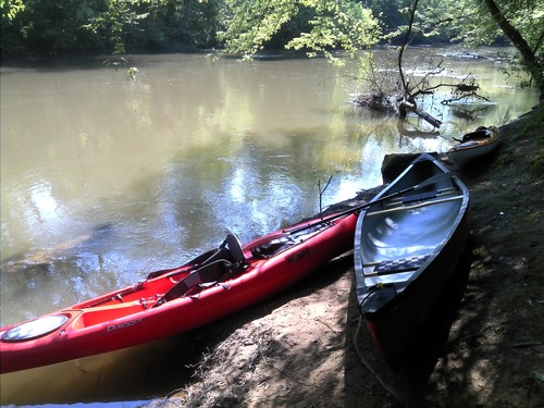
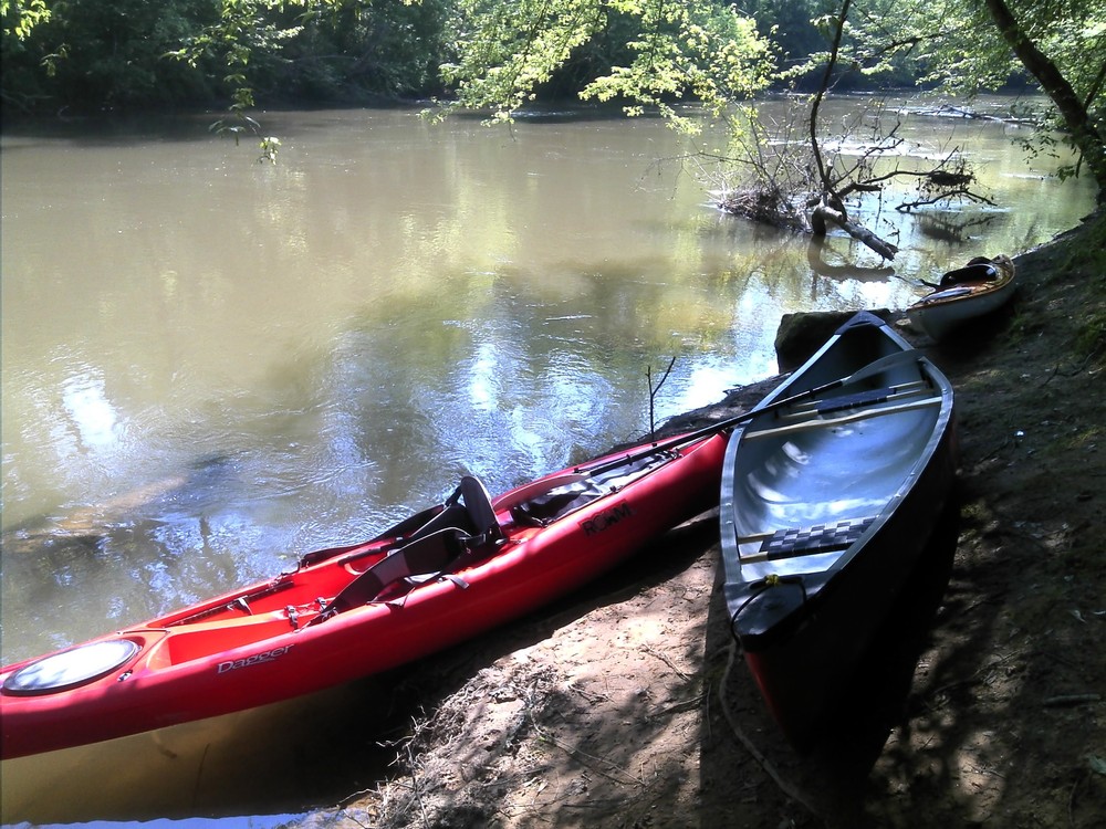
Access is downstream of the Old Hunts Bridge Road bridge, river-right. The banks are steep; use caution. Park along Hunts Bridge Road, river-right. This access is unofficial but regularly used. Use at your own risk. 

Trip Details

Hunts Bridge Road is a 25 minute drive from Old Settlement Road; shuttling cars could take close to an hour. There is a high potential for woody debris along this section; paddlers should use caution at all times. Once on the river, paddlers will cross under 6 bridges. The 4th bridge is adjacent to Beechwood Farms. After the 6th bridge, the North and South Saluda Rivers converge, forming the main stem Saluda River. After the confluence, there are Class II-III rapids and shoals. The next road crossing is Old Hunts Bridge Road; take out upstream, river right. Limited roadside parking is available along Hunts Bridge Road. For more information see The Upper Saluda River Blueway map.

Comments (1)

Please Sign In or Create Account to add your photo to this trip
Sean McLaughlin
Jun 05, 2022 11:55 am EDT
Great first canoe trip in SC. Rained on us all day but overall great river for beginners. Water was running about 40CFS. One hairy spot where trees are across the river. Parked off road next to put in. Fished but water was really muddy due to so much rain over the last couple of days. I’d do it again.
Please Sign In or Create Account to add your photo to this trip
Hunts Bridge Road access (Credit: Upstate Forever)
Trip Resources
River Flow (CFS)
Discharge flow information
CURRENT CFS
Flows for safe padding (cfs)
MINIMUM
--
MAXIMUM
--
X Close
Skill Level
Easy
Moderate
Difficult
Advanced
Learn more
X Close
Flow Level
Runnable
Above Runnable
Below Runnable
No Information
Learn more
X Close
Skill & Flow Level
Easy
Moderate
Difficult
Advanced
Runnable
Above Runnable
Below Runnable
No Information
X Close
Access Amenities
Parking - Dedicated Lot
Parking - Roadside
Restroom / Toilets
Fee Required
Handicap Accessible
Camping
Paddle SC is presented by
Upstate Forever
South Carolina Department of Natural Resources
South Carolina National Heritage Corridor
Rainey Foundation