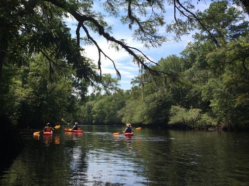
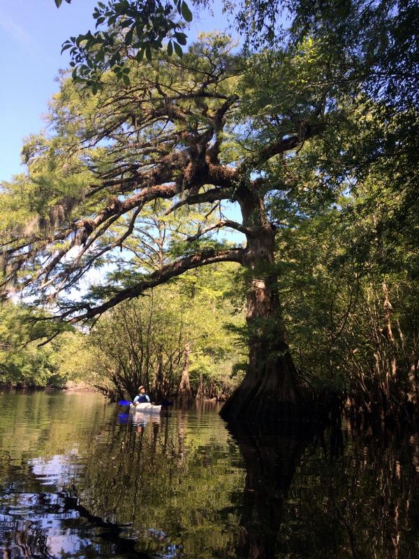
The Black River is a free-flowing Coastal Plain river bordered by a rural landscape of forests and farmlands. The river corridor presents a ribbon of dense swamp forests, dark waters, and white sandbars. The Black River is named for its black water, darkly stained and resembling a tea or coffee color, which results from the tannins leached from plant material in the surrounding swamps. The channel pattern of the Black River alternates from large, open "lake-like" areas to narrow channels. At lower water levels, there are numerous sand bars.
A 75-mile segment of the Black River is designated a State Scenic River and the designation extends from State Road 40 Bridge in Clarendon County, through Williamsburg County, and ends at Pea House Landing in Georgetown County.
The newly established Black River State Park is now open for visitors at its "Meadows" park site (located here) and the "Narrows" access site on Lester Creek (located here). A series of additional park properties will be opened in the future. The State Park is part of the larger Black River Water Trail and Park Network Project, an initiative of the Open Space Institute, S.C. State Parks, The Nature Conservancy, Winyah Rivers Alliance, and other partners to establish a recreational water trail connecting a growing network of public lands, along 70 miles of the Black River.
Navigation note: Some sections of the Black River upstream of Pea House Landing are difficult to navigate when river-water-level conditions are low. When the USGS gage height at Kingstree is reading 2-feet or lower, several sections of the river channel become shallow and boaters have to walk rather than float those river sections.
Adjacent Waterways: on-stream, Pocotaligo River; downstream, Pee Dee River and Winyah Bay (Coastal).
Featured trips for this waterway showing difficulty (circles) and current runnability status (squares). .


