Although this trip is considered Novice in terms of rapid difficulty, it requires portage around two dams and may not be well suited for families with young children, inexperienced paddlers, or those unable to carry boats along primitive trails.
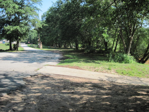
The upstream and downstream dams create lake-like paddling conditions at this river access and this section is very beginner-friendly. Paddlers can travel upstream or downstream, using Lyman Street Landing as a start and end point. Lyman Street Landing has a large paved parking lot and a boat ramp, and is open from dawn to dusk. While portage around the downstream dams is available.
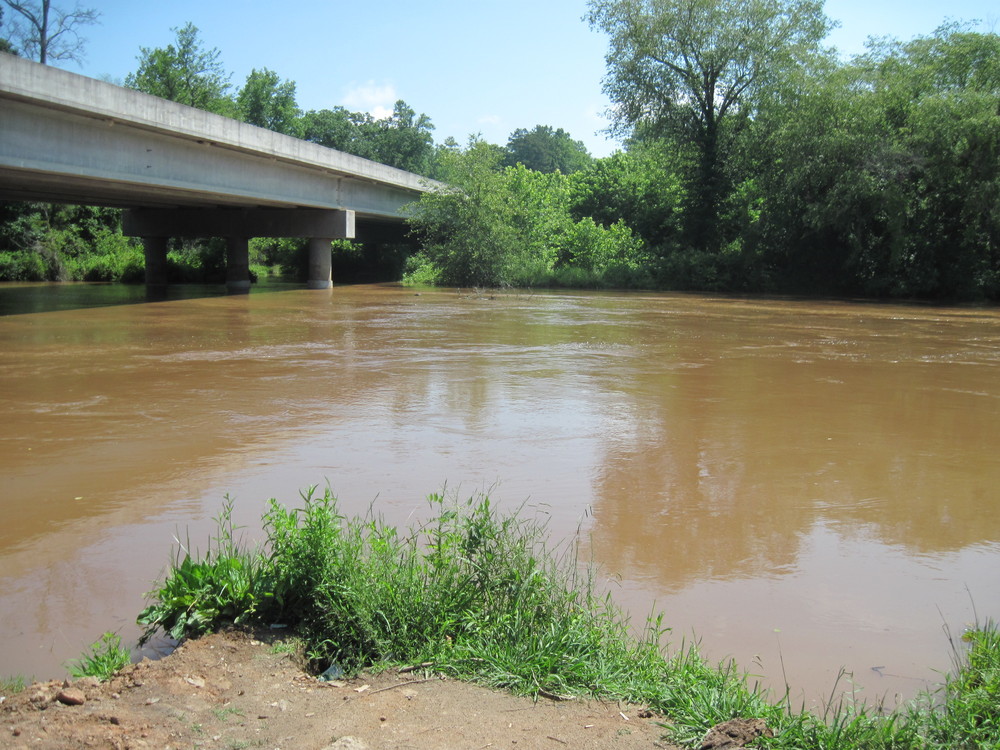
This access is river-right, south of the Cooley Bridge Road/Belton Highway bridge. The Holliday dam creates lake-like paddling conditions here, which offers the opportunity to use Cooley Bridge Road as the put-in and take-out. Portage around the Holliday Dam is not currently available.
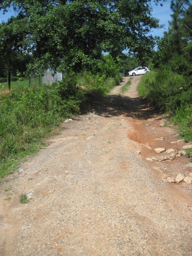
This trip begins on the southern border of the Town of Pelzer and ends west of the Town of Belton. The take out on Cooley BridgeRoad / Belton Highway is a 15 minute drive from Lyman Street Landing. Lyman Street Landing is located at the very end of Lyman Street; the road dead-ends into the parking area/landing. Lyman Street Landing has a large paved parking area, a boat ramp, and areas for fishing and picnicking. The Landing is open from dawn to dusk. Once on the river, the water is flatwater for the first 2.5 miles until the first dam, the Lower Pelzer Mills Dam. Upon nearing the dam, stay to the right. Portage isavailable river-right. Exit the river and follow the dirt road, which turns into Dunlap Road. Past the dam, bear left onto the path leading to the dam's facilities and re-enter the river below the brick building. Once back on the river, paddlers will soon encounter the Lee Steam Plant Dam approximately 2 miles downstream. Upon nearing the Lee Steam Plant Dam, stay to the left; portage is available river-left. Exit the river and follow the dirt path to a point below the dam, re-entering the river on river-left. Immediately downstream of this dam, there are a few Class I/II rapids for the next 1.6 miles. Paddlers will cross under the Lee Steam Plant Road bridge just downstream of the 2nd dam. After the 1.6 miles of rapids, the water is primarily flatwater until the take out. The next bridge is Cooley Bridge Road. Paddlers should stay to the right and take out downstream of the bridge, river-right. Limited parking is available along Cooley Bridge Road. Follow the path from the river 250 feet to the roadside. Do not block the gates to the utility facilities. This is the last take out before the Holliday Dam, and there is no portage around the dam. Paddlers should take out at Cooley Bridge Road and re-enter the river below the Holliday Dam at the Holliday Dam Road River Access.


Comments (0)