Paddle SC
Camping Fee Required Handicap Accesible Parking- Dedicated Lot Roadside Parking Restrooms / Toilets

Reedy River: Cleveland Park to Parkins Mills Road (Unofficial)

Scroll down for more details
Legend
Hide All

Reedy River: Cleveland Park to Parkins Mills Road (Unofficial)

Skill Level: Moderate
Loading 
Rapids: Class I , II
Length: 3.80 miles
Duration: 2 - 2.5 hours
Portaging: Yes
What to Expect

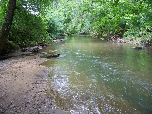
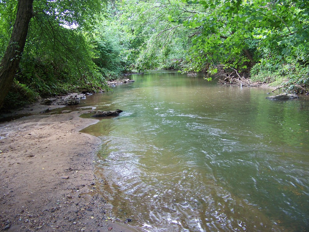
Extremely convenient to downtown Greenville, SC, this paddle trip is scenic, however has a high probability of woody debris. Although easy in terms of skill level, portaging fallen trees can be difficult. This trip would be better suited at higher water levels.

Access
Put in:
Cleveland Park River Access and Parking Area
 160 Lakehurst Street, Greenville, SC 29601
Access Details

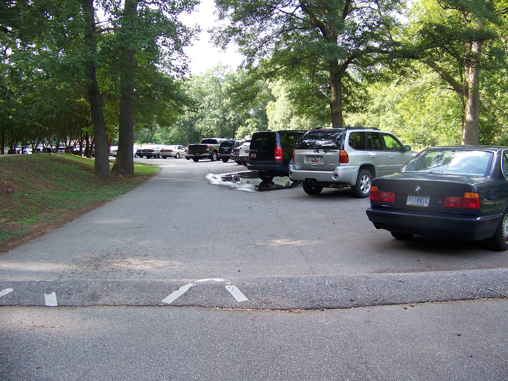
This 122-acre park offers a myriad of recreation opportunities including access to the Swamp Rabbit Trail, fitness trails, picnic shelters, playgrounds, and sports fields. The park is open from 8 AM to 9 PM daily. Park in the horseshoe parking lot on Lakehurst Street, near Woodland Way.  River access is located across the grass from the parking area, river-left.  Parking is limited. For more information, visit: www.greenvillesc.gov

Take out:
Parkins Mill Road / Mauldin Road (Unofficial)
 1829 Parkins Mill Road, Greenville, SC 29607
Access Details

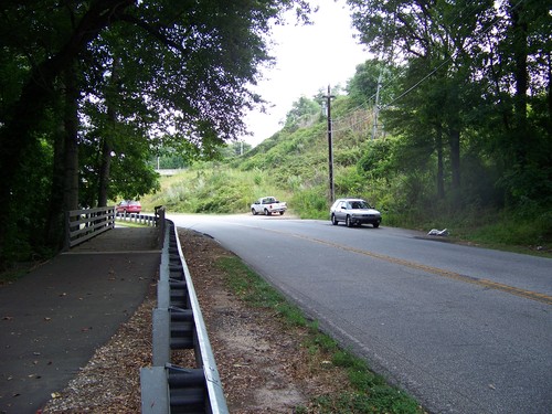
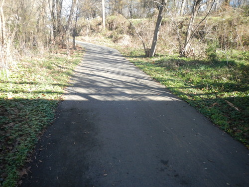
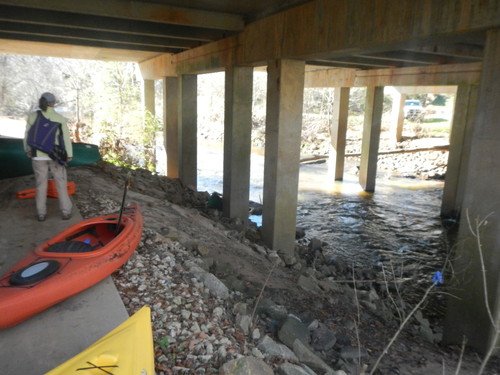
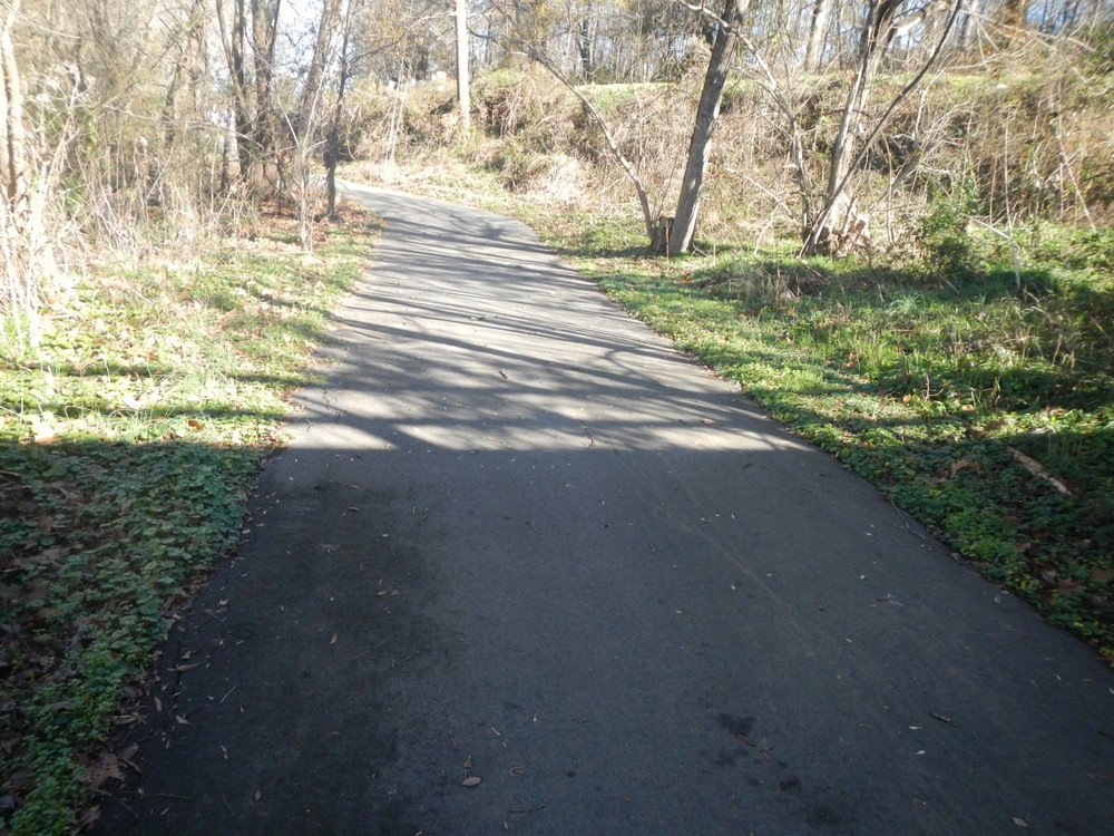
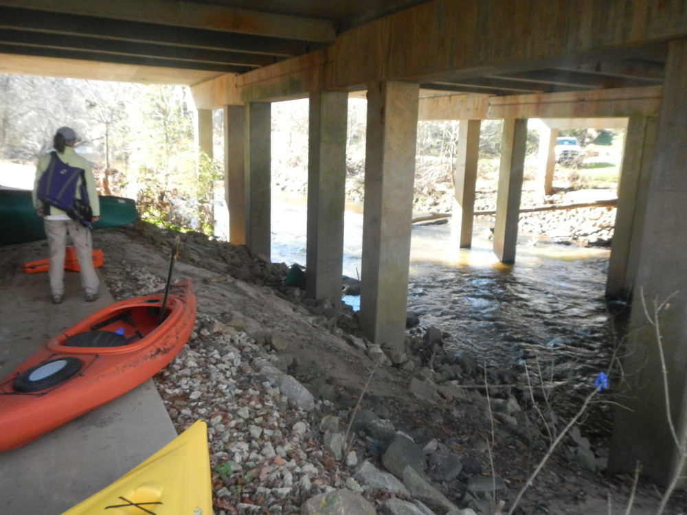
This is the last take out before the Lake Conestee Dam (no portage). After crossing under the I-85 bridge, take out river left under the Mauldin Rd. bridge and portage boats 650 feet up the Swamp Rabbit Trail (parallel to Parkins Mill Road) to the roadside pulloff area next to the power line. Though unofficial, this access is widely used. Use at your own risk. Access to the Swamp Rabbit Trail is also available.

Trip Details

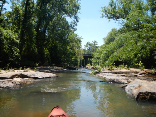
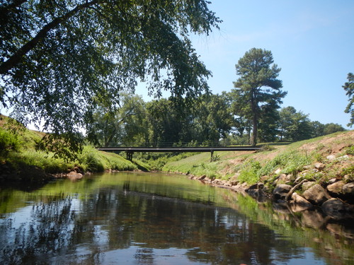
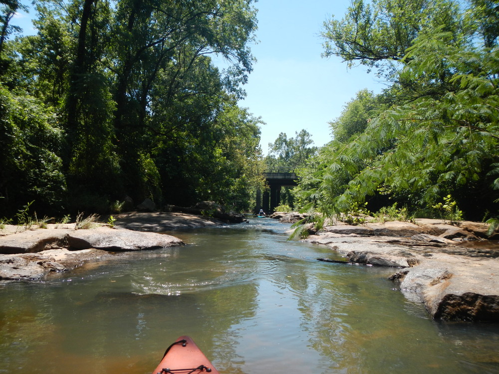
This trip begins in downtown Greenville's popular Cleveland Park. Ending at Pelham Mill Road right next to the Swamp Rabbit Trail / Greenway, this section of the Reedy River is very close by to other recreation opportunities. Paddlers should put in near the corner of Lakehurst Street and Woodland Way; a parking area is located on Lakehurst Street adjacent to a small playground. The put in is directly across the grassy area from the parking lot (put in is not marked). After putting in, paddlers will cross under the Woodland Way bridge, then under two Swamp Rabbit Trail bridges. After the next two bridges, paddlers will float through the Riverside Golf Course - a scenic view with grassy banks. After the golf course, paddlers will exit the river at the third bridge which will be Mauldin Road. Take out under the bridge and portage boats north along the Swamp Rabbit Trail to the Parkins Mill Road roadside pull-off. Paddlers will cross under 8 bridges, and Mauldin Road is the 9th bridge. This is the last take-out before Lake Conestee Nature Park. There is no portage around the Lake Conestee Dam, and no river access at the Park. Paddlers should take out at the Mauldin Road bridge. 

Waterway: 

Comments (2)

Please Sign In or Create Account to add your photo to this trip
Derek Porter
Jun 29, 2020 2:15 am EDT
Apend to above...ran at CFS 65 on Greenville USGS guage. No problems with low water except for one shoal that I should have walked the boat down. Left a lot of Royalex on that shoal. Other than the blockages, nice paddle. I would not float it any lower. If blockages removed I would paddle it again with no hesitation at 65 CFS.
Derek Porter
Jun 29, 2020 2:10 am EDT
Floated this stretch on 6/27/2020. At least 6 log jams that required getting out of the boat. Most required lifting boat over logs. A couple were very sketchy if you are solo which I was. Most of the really bad ones involved old log jams with fresh blow down right on top of them. Talked to Security Manager of Country Club and he said a few days ago a storm had hit and they lost several trees. I was doing a fishing trip on this float and had a GoPro on most of the time. If ya want to see how bad this is, I published a You Tube video tonight. Absolute beautiful float but the county needs to clear out the main blockages. Proceed with caution and with some pals along. https://youtu.be/ZoKhDk1YP5o
Please Sign In or Create Account to add your photo to this trip
Cleveland Park river access (Credit: Upstate Forever)
Lakehurst Street parking area (Credit: Upstate Forever)
parking area as viewed from Swamp Rabbit Trail across the street (Credit: Upstate Forever)
Swamp Rabbit Trail above Mauldin Road bridge (Credit: Upstate Forever)
underneath the Mauldin Road bridge (Credit: Upstate Forever)
shoals just above Mauldin Road Bridge (Credit: Upstate Forever)
Reedy River through Greenville Country Club (Credit: Upstate Forever)
Trip Resources
Download map files for your own use. Learn more
River Flow (FT)
Discharge flow information
CURRENT FT
Flows for safe padding (ft)
MINIMUM
4.8
MAXIMUM
12
X Close
Skill Level
Easy
Moderate
Difficult
Advanced
Learn more
X Close
Flow Level
Runnable
Above Runnable
Below Runnable
No Information
Learn more
X Close
Skill & Flow Level
Easy
Moderate
Difficult
Advanced
Runnable
Above Runnable
Below Runnable
No Information
X Close
Access Amenities
Parking - Dedicated Lot
Parking - Roadside
Restroom / Toilets
Fee Required
Handicap Accessible
Camping
Paddle SC is presented by
Upstate Forever
South Carolina Department of Natural Resources
South Carolina National Heritage Corridor
Rainey Foundation