Paddle SC
Camping Fee Required Handicap Accesible Parking- Dedicated Lot Roadside Parking Restrooms / Toilets

Enoree River: Forest Service 339 Landing to Brazlemans Bridge Road

Scroll down for more details
Legend
Hide All

Enoree River: Forest Service 339 Landing to Brazlemans Bridge Road

Skill Level: Easy
Loading 
Rapids: None
Length: 11.50 miles
Duration: 6 - 6.5 hours
Portaging: No
What to Expect

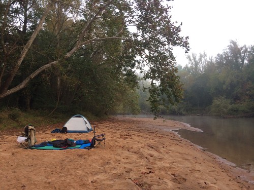
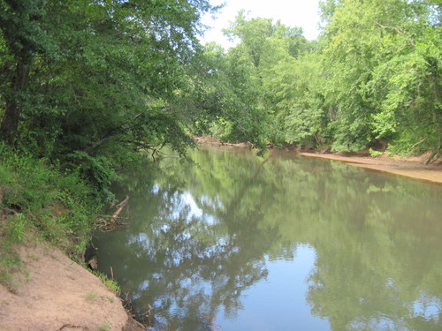
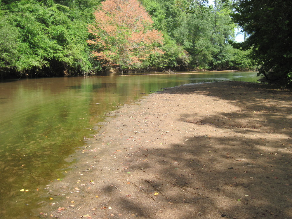
The Enoree River passes through the small town of Whitmire along this trip, though it is primarily rural in nature. After the bridge at Whitmire, the environment quickly becomes more like wilderness. This flatwater trip is great for beginners. During lower water, paddlers will need to navigate around shallow sand bars and fallen trees. This trip can be combined with other sections for excellent overnight and weekend camping trips. 

Access
Put in:
Forest Service 339 Landing River Access and Parking Area
 FS 339 Road, Whitmire, SC 29178
Access Details

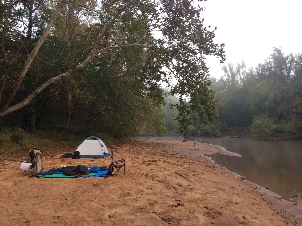
This landing is located 1 mile upstream of the US-176 and SC-72/121 bridge at Whitmire, and has parking and a small beach. From Lee Cemetery Road, turn west onto FS-339 and continue to the landing, which is located river-left. The landing is not well marked from the river. Visit the Forest Service website for more information.

Take out:
Brazelmans Bridge Road River Access and Parking Area
 3720 Brazelmans Bridge Road, Newberry, SC 29178
Access Details

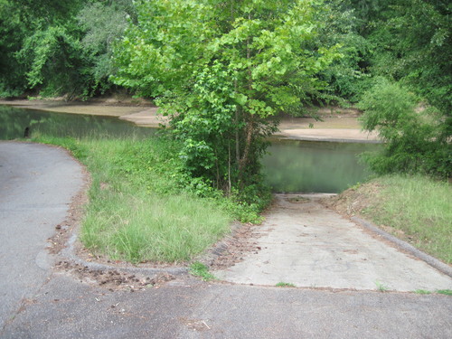
The landing is downstream of Brazelmans Bridge Road, river-left. Directional signage from the road will lead you to a small parking area and concrete boat ramp. Visit the Forest Service website for more information.

Trip Details

The take-out is a 20 minute drive from the put-in, so shuttling cars may take around 45 minutes. Primarily rural in nature, this flatwater trip crosses under only 2 bridges (1 railroad bridge and the Highway 176 bridge) before the take out.

Waterway: 

Comments (3)

Please Sign In or Create Account to add your photo to this trip
Shane Cropper
Jan 22, 2023 4:16 pm EST
Leg 3/4 of a weekend kayak/camping trip that started at Jones Ford Road and ended at Keitts Bridge. CFS was around 400. Put in: Did not use as I was already on the river but looked easy to use. Skill Level: Lots of trees in the water that did require some skill at the high end of easy or low moderate. One portage that was really easy. Maybe 25 yards total but did have to lift the kayak over two trees. Take Out: Easy access with parking. The ramp was muddy at the bottom but easy to navigate. Wildlife: Lots of birds including ducks and geese. One Bald Eagle that kept trying to get ahead of me on the river so I followed him for at least half a mile. Camping: At this water level there were only selected places to leave the river. The easiest were the relatively frequent sandbars. Provided you could get off the river there were plenty of great sites. Overall: Did not see a single additional person during this entire trip. Great for someone comfortable in the water that does not mind navigating around the frequent trees and that wants to get away for a few hours or a weekend.
Steve Vislay
Apr 08, 2021 4:21 pm EDT
My son and I went on a day trip on this section of the river yesterday, April 7, 2021 (FS 339 Road to Brazleman's Bridge Landing). The weather couldn’t have been nicer and the rivers water flow (CFS) was showing at 552. While there were no log jams that required portage, there were a couple of spots where the trees in the water made for narrow navigation and if the water was any lower it might cause portage. We got to see beavers, river otters, ducks, deer and lots of butterflies. It was a great trip! Very beautiful river!!
Tanya Towne
May 20, 2019 7:41 am EDT
We went on a overnight trip on this section of the river this weekend, May 18 - 19, 2019. There are a couple of log jams that you will be able to go over. Also there is a large log jam about a mile from Brazzleman's Bridge. It will require portage! We went up the bank on the left side and found a way to carry our 3 loaded kayaks around the obstruction. The bank was steep and we slipped in the mud several times getting back into the water. Other than the last log jam, it was a great trip! Very beautiful river!
Please Sign In or Create Account to add your photo to this trip
Enoree River at FS 339 (Credit: Upstate Forever)
Sand bar camping on Enoree River - 180 cfs (Credit: Tanner Arrington)
Boat Ramp at Brazelman's Bridge Road (Credit: Upstate Forever)
Enoree River at Brazelman's Bridge Road (Credit: Upstate Forever)
Trip Resources
Download map files for your own use. Learn more
River Flow (CFS)
Discharge flow information
CURRENT CFS
Flows for safe padding (cfs)
MINIMUM
250
MAXIMUM
1500
X Close
Skill Level
Easy
Moderate
Difficult
Advanced
Learn more
X Close
Flow Level
Runnable
Above Runnable
Below Runnable
No Information
Learn more
X Close
Skill & Flow Level
Easy
Moderate
Difficult
Advanced
Runnable
Above Runnable
Below Runnable
No Information
X Close
Access Amenities
Parking - Dedicated Lot
Parking - Roadside
Restroom / Toilets
Fee Required
Handicap Accessible
Camping
Paddle SC is presented by
Upstate Forever
South Carolina Department of Natural Resources
South Carolina National Heritage Corridor
Rainey Foundation