Paddle SC
Camping Fee Required Handicap Accesible Parking- Dedicated Lot Roadside Parking Restrooms / Toilets

Enoree River: Brazlemans Bridge Road to Keitts Bridge Landing

Scroll down for more details
Legend
Hide All

Enoree River: Brazlemans Bridge Road to Keitts Bridge Landing

Skill Level: Moderate
Loading 
Rapids: Class I
Length: 5.70 miles
Duration: 3 - 3.5 hours
Portaging: No
What to Expect

This flatwater trip is primarily rural in nature. Woody debris and fallen trees are common through this section, especially at lower water levels. This trip can be combined with other sections for excellent overnight and weekend camping trips. 

Access
Put in:
Brazelmans Bridge Road River Access and Parking Area
 3720 Brazelmans Bridge Road, Newberry, SC 29178
Access Details

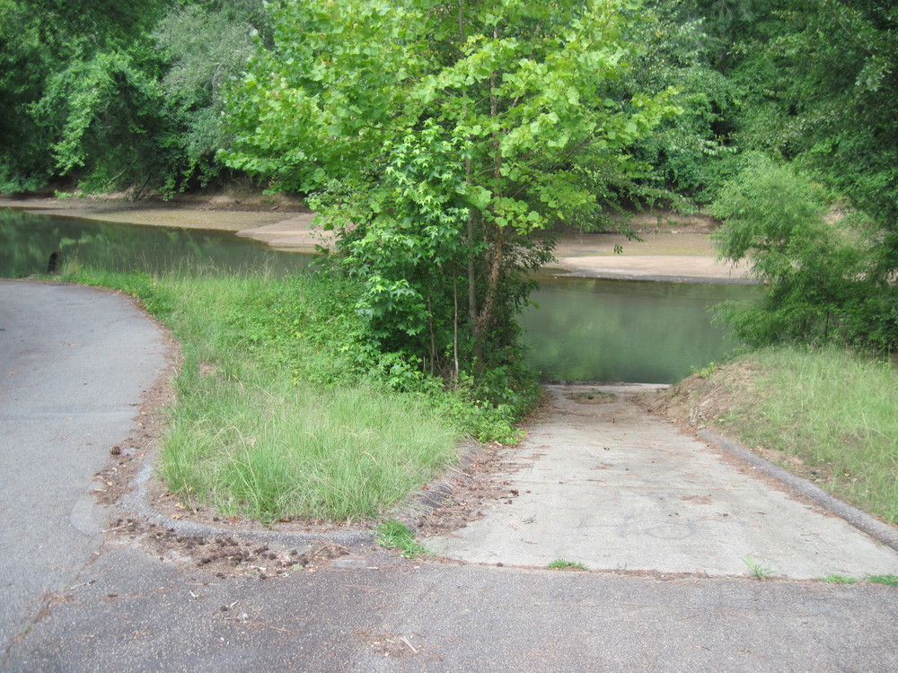
The landing is downstream of Brazelmans Bridge Road, river-left. Directional signage from the road will lead you to a small parking area and concrete boat ramp. More information.

Take out:
Keitts Bridge Landing at Maybington Road River Access and Parking Area
 2-50 Enoree Trail, Newberry, SC 29108
Access Details

Keitts Bridge Landing is downstream of the Maybinton Road bridge, river-right. The drive to the landing connects to the highway on the upstream right side. Drive under the bridge to a small clearing. This is the last take out before the Eonree's confluence with the Broad River. The next take out is Strother Landing on the Broad River. More information.

Trip Details

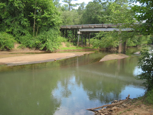
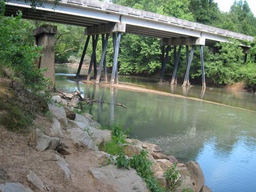
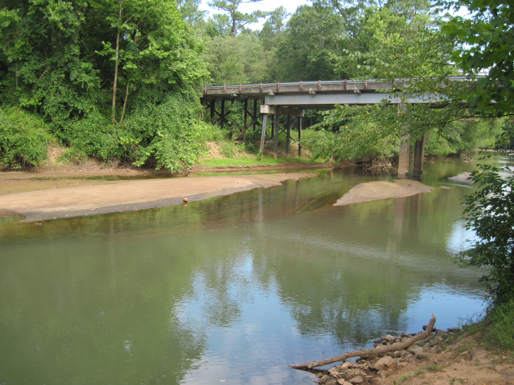
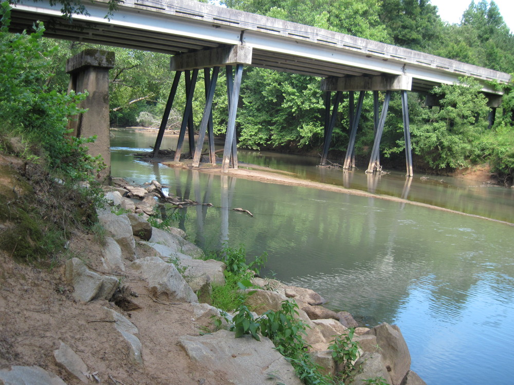
The take out is only 10 minutes away from the put in making shuttling cars quick and easy. The scenery for this trip is primarily forested, although paddlers may see some areas of wetlands and marsh, especially in winter months when there are not many leaves on the trees. The take out is the only bridge after putting in the river, so paddlers will easily be able to find it. Take out is upstream of the bridge, river right.

Waterway: 

Comments (6)

Please Sign In or Create Account to add your photo to this trip
Rachel Seydlitz
Jul 24, 2023 3:27 pm EDT
We went when CFS was around 425. Lots of trees down but only one place was unnavigable, as noted by others.
Shane Cropper
Jan 22, 2023 4:36 pm EST
To clarify my previous comment. the paddle times and dates on when I started refer to an entire four leg trip from Jones Ford Road to Keitts Bridge Landing and not just the final leg from Brazleman's Bridge Road to Keitts Bridge Landing.
Shane Cropper
Jan 22, 2023 4:29 pm EST
Leg 4/4 of a weekend kayak/camping trip that started at Jones Ford Road and ended at Keitts Bridge. CFS was around 500, which was up about 100 CFS from the previous legs because of rain that started around midnight. Put in: Not sure because I was already on the river. Looked easy with lots of parking. Skill Level: Lots of trees in the water that did require some skill at the high end of easy or low moderate. One very large logjam that required about 75 yards of portage. Might be the same one reported in 2020 as it was about the same place and looked old. Take Out: End of my trip. Ramp was steep but easy to navigate. I left my Jeep parked there from Friday to Sunday and it was not disturbed. Wildlife: Lots of birds including ducks and geese. Camping: At this water level there were only selected places to leave the river. The easiest were the relatively frequent sandbars. Provided you could get off the river there were plenty of great sites. I spent the night on this section near the logjam and used a tent this time instead of a hammock due to expected rain. A dog barked all night, which was the closest I came to seeing a person the whole weekend. Overall: Did not see a single additional person during this entire trip. Great for someone comfortable in the water that does not mind navigating around the frequent trees and that wants to get away for a few hours or a weekend. Write-ups say this was 17-19 hours total paddle time. I did it in about 14 but pushed pretty hard because I wanted my paddle time in the rain to be minimal on my last day. Extremely enjoyable trip that can be done in a weekend. I was in the water on Friday at 6:30 pm and off the water at 9:30 am on Sunday. As mentioned though this required very little downtime as I pushed to avoid rain.
Tad A
Jun 03, 2020 1:16 pm EDT
Ran this on 05.28.2020. River level and flow were up and right at the max suggested CFS. We hit one MASSIVE log jam about halfway through this run. Evidently it has gotten really bad after the rains a week ago. Fortunately we were able to portage around about 75 yards and continue on. There were a good many trees to keep you paddling side to side to get around but that's part of the fun. The log jam was not fun with the increased flow. The gauge on the Enoree at Whitmire measured 934CFS & 18FT. Definitely the most water I've ever had on a trip down the Enoree. I'd recommend a little less of both of those. Trip took 3hrs, log jam was right at the entrance to horseshoe bend at 34.413610 & -81.501838. Portage was to the left bank looking downstream. I hung a streamer of pink flagging.
Tanya Towne
May 20, 2019 8:12 am EDT
This was a nice stretch. We kayaked on May 19, 2019 and while there were some log jams none of them required portage around. We ended up lifting the kayaks over the logs.
Tanya Towne
May 20, 2019 8:12 am EDT
This was a nice stretch. We kayaked on May 19, 2019 and while there were some log jams none of them required portage around. We ended up lifting the kayaks over the logs.
Please Sign In or Create Account to add your photo to this trip
Looking at Brazelman's Bridge from the landing (Credit: Upstate Forever)
Looking at Maybinton Road from Keitts Landing (Credit: Upstate Forever)
Enoree 3' above median height and 934CFS. (It's usually nowhere close to this wide!) (Credit: Tad Abraham)
Trip Resources
Download map files for your own use. Learn more
River Flow (CFS)
Discharge flow information
CURRENT CFS
Flows for safe padding (cfs)
MINIMUM
250
MAXIMUM
1000
X Close
Skill Level
Easy
Moderate
Difficult
Advanced
Learn more
X Close
Flow Level
Runnable
Above Runnable
Below Runnable
No Information
Learn more
X Close
Skill & Flow Level
Easy
Moderate
Difficult
Advanced
Runnable
Above Runnable
Below Runnable
No Information
X Close
Access Amenities
Parking - Dedicated Lot
Parking - Roadside
Restroom / Toilets
Fee Required
Handicap Accessible
Camping
Paddle SC is presented by
Upstate Forever
South Carolina Department of Natural Resources
South Carolina National Heritage Corridor
Rainey Foundation