Paddle SC
Camping Fee Required Handicap Accesible Parking- Dedicated Lot Roadside Parking Restrooms / Toilets

Catawba River: Landsford Canal State Park

Scroll down for more details
Legend
Hide All

Catawba River: Landsford Canal State Park

Skill Level: Moderate
Loading 
Rapids: Class I
Length: 1.50 miles
Duration: 1 - 2 hours
Portaging: No
What to Expect

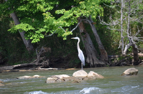
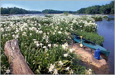
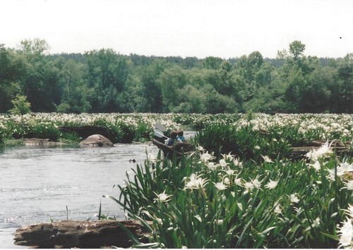
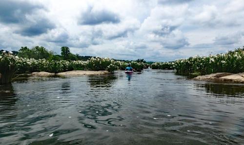
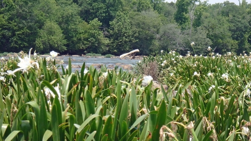
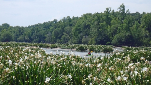
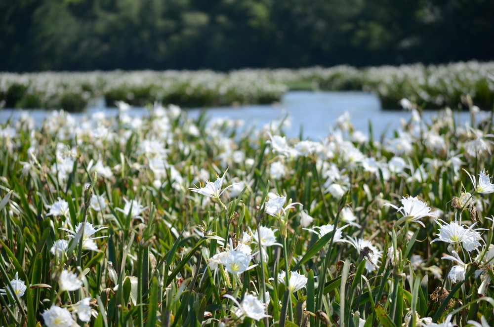
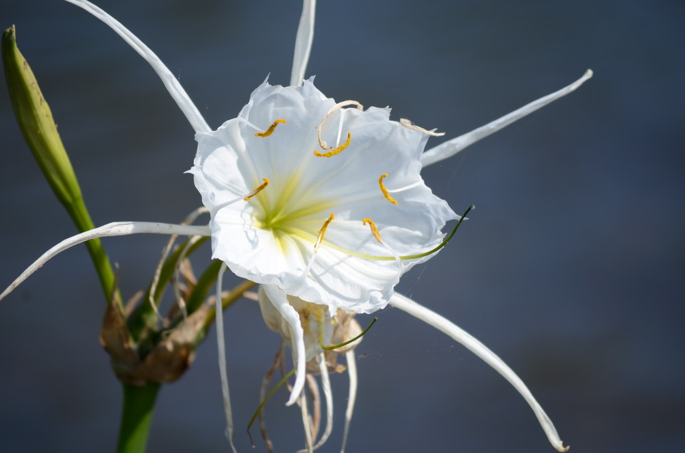
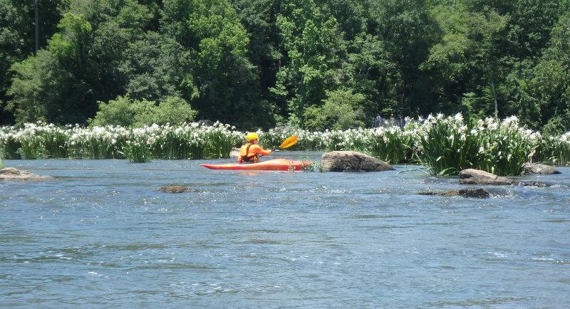
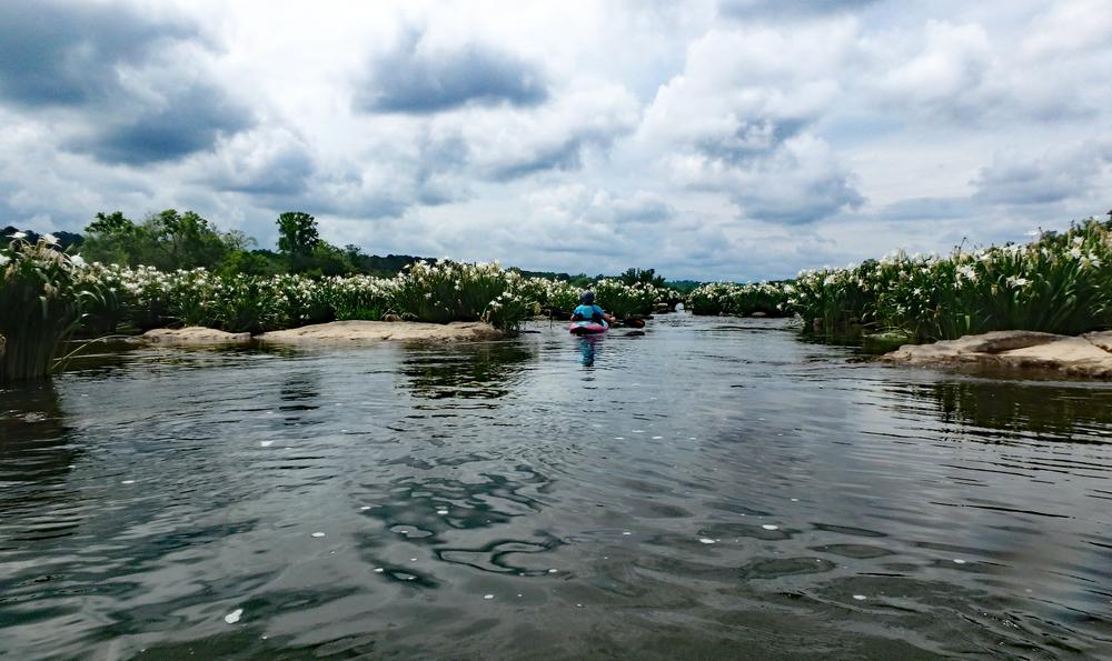
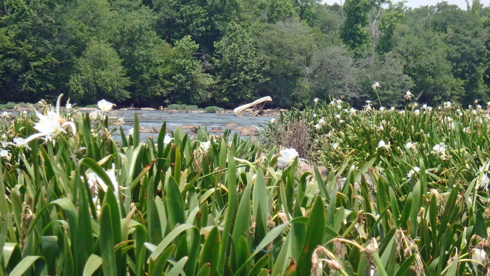
Landsford Canal State Park is home to the world’s largest colony of Rocky Shoals Spider Lilies. Paddling through the shoals is an excellent way to view these beautiful flowers that bloom each year along the Catawba River from May through mid-June. 

Access
Put in:
Landsford Canal State Park Put-in
Access Details

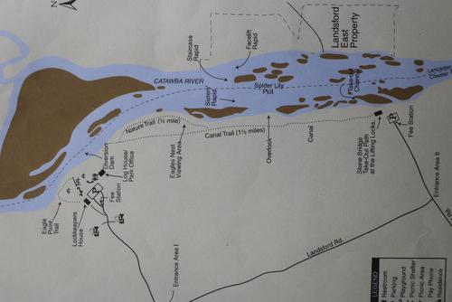
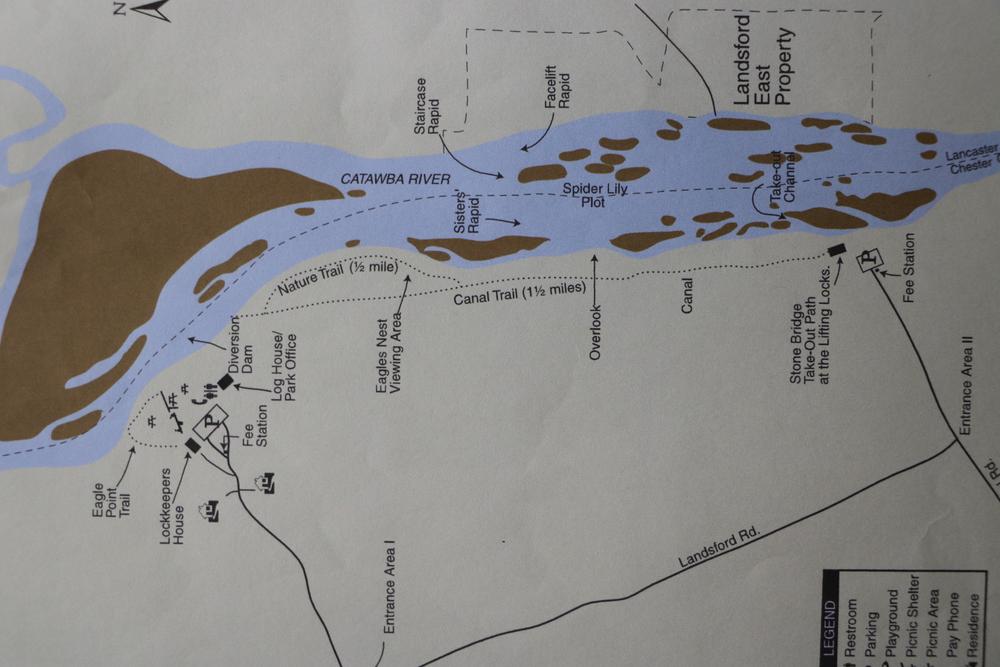
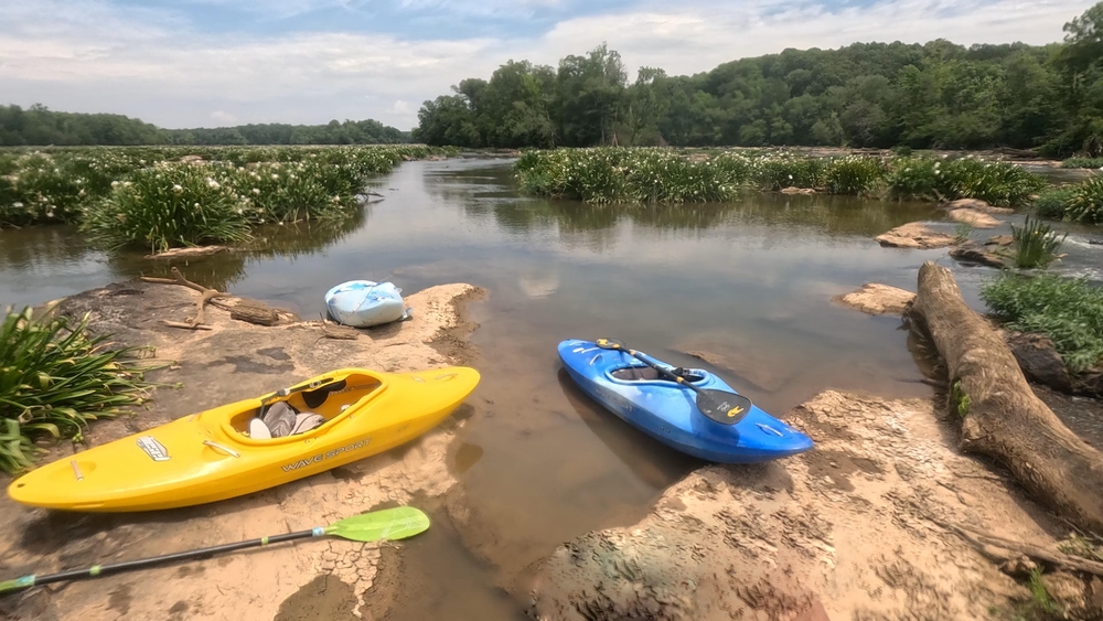
Lansford Canal State Park has two road entrances and two access points to the river. This trip starts from the main entrance road, which is Park Drive. The put in, river access site is at the end of Park Drive.

Take out:
Landsford Canal State Park - Lower Entrance/Access at Canal Road
Access Details

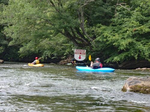
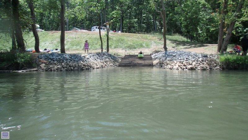
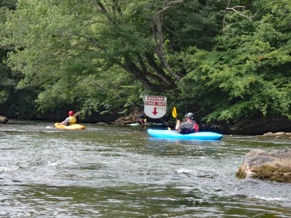
Take out at the lower (South) park entrance at Canal Road from a river access site at the end of Canal Road.

Trip Details

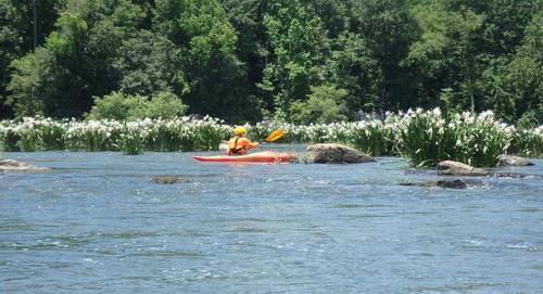
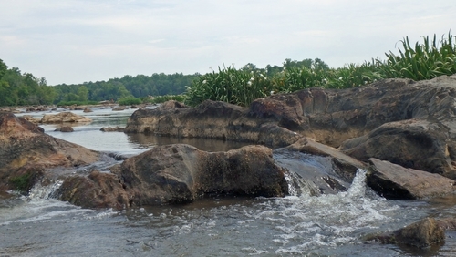
Enjoy a beautiful 1.5-mile paddle through the largest known colony of Rocky Shoals Spider Lilies, all within Landsford Canal State Park. During peak season, which is May through mid-June, the white lilies appear to cover the shoals from one bank to the other. The Rocky Shoals Spider Lily gets its name from the rocky-cobbled shoals in the river where it grows. Because there are many shoals and small rapids that must be navigated throughout this trip, it is more suitable for those with some paddling experience in maneuvering quick turns in narrow channels.  

Landsford Canal State Park hosts Lily Fest every year during the blooming season. 

Waterway: 

Comments (3)

Please Sign In or Create Account to add your photo to this trip
Paula Cumalander
Mar 16, 2021 4:32 pm EDT
On river left of the lily route, there are 2 rapids. See photos for detailed map. Staircase Rapid and Facelift Rapid. We like to do the trip twice. Once through the lilies and then on the river left side. Just remember that after the island, you will have to get to river right very fast. It was shallow here and we actually had to get out and drag the kayaks to get to deeper water to get to the take-out. I'm not sure what the flow was that day. These rapids are class 1-2 and can be class 3 at high water. Attaching an article I found on Paddling.com " A fun area is at a drop about 1 mile from the main park area. The river is about 1500 feet wide here so the key is asking park staff where to go to find the play spots. The biggest drop is "staircase". A left side entry into a slight "s" turn drops about 7-8 feet in about 25 feet. Nice "v" wave at the bottom allows for some interesting surfing at normal water. If you catch high water, this chute can really roll! A few hundred feet on river left is "facelift"; a small hydraulic with a decent backflow at good water levels. Enough room at good water level for some enders. This rapid tails out with 3-4 good "camel humps". The thing to remember is at low levels, getting to these places can be a lot of work. Exposed rocks and rock shelves make getting there difficult."
Julia Hayes
Jul 21, 2019 10:14 am EDT
Ideal flow is between 4000-5000 cfs.
Bob Thomason
May 29, 2019 2:02 pm EDT
There is no minimum or maximum flow mentioned on the site but does anyone know what the ideal flow is?
Please Sign In or Create Account to add your photo to this trip
Kayaking down the Catawba River May 2017 (Credit: Todd Betlem)
Blue Haron on the Catawba River May 2017 (Credit: Todd Betlem)
Spider Lily bloom May 2017 (Credit: Todd Betlem)
Rocky Shoals Spider Lilies at Landsford Canal State Park (Credit: South Carolina Department of Parks, Recreation & Tourism)
Pathway between the lilies
Kayak launch at State Park (Credit: pcumalander-frick)
Two points of view.  From water and from the viewing deck. (Credit: pcumalander-frick)
Take-out at the lower end of the State Park.  There is a sign for it on river right. (Credit: pcumalander-frick)
Map of park showing lily route. (Credit: pcumalander-frick)
Boater take-out sign (Credit: pcumalander-frick)
(Credit: pcumalander-frick)
Trip Resources
Download map files for your own use. Learn more
River Flow (CFS)
Discharge flow information
CURRENT CFS
Flows for safe padding (cfs)
MINIMUM
--
MAXIMUM
--
X Close
Skill Level
Easy
Moderate
Difficult
Advanced
Learn more
X Close
Flow Level
Runnable
Above Runnable
Below Runnable
No Information
Learn more
X Close
Skill & Flow Level
Easy
Moderate
Difficult
Advanced
Runnable
Above Runnable
Below Runnable
No Information
X Close
Access Amenities
Parking - Dedicated Lot
Parking - Roadside
Restroom / Toilets
Fee Required
Handicap Accessible
Camping
Paddle SC is presented by
Upstate Forever
South Carolina Department of Natural Resources
South Carolina National Heritage Corridor
Rainey Foundation