Paddle SC
Camping Fee Required Handicap Accesible Parking- Dedicated Lot Roadside Parking Restrooms / Toilets

Reedy River: Cedar Falls Park to Dunklin Bridge Road (Unofficial)

Scroll down for more details
Legend
Hide All

Reedy River: Cedar Falls Park to Dunklin Bridge Road (Unofficial)

Skill Level: Moderate
Loading 
Rapids: Class I , II
Length: 9.00 miles
Duration: 4.5 - 5 hours
Portaging: No
What to Expect

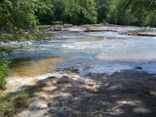
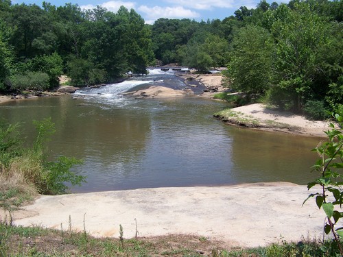
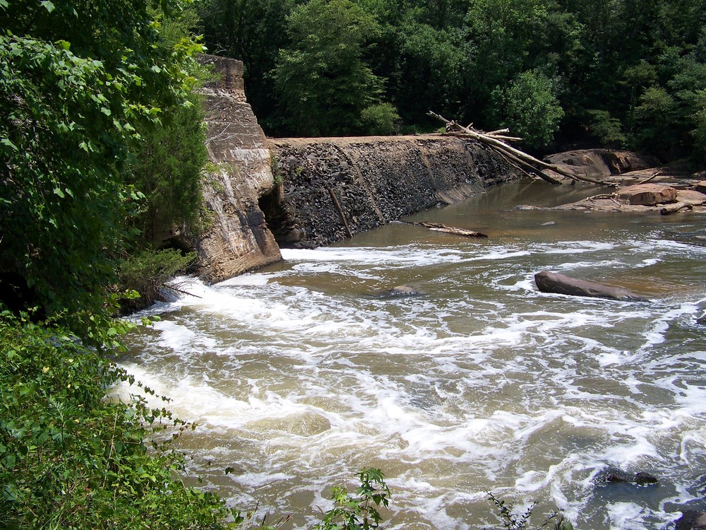
This trip begins at the popular Cedar Falls Park and ends 9 miles downstream at Dunklin Bridge Road. Mostly characterized by flatwater, there are some exciting lengthy stretches of Class I-II rapids along the way. 

Access
Put in:
Cedar Falls Park River Access and Parking Area
 245 Cedar Falls Road, Pelzer, SC 29669
Access Details

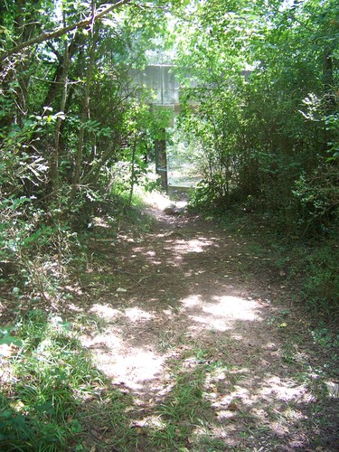
Hours for the park are 9:00 AM to dusk. River access is located at the south entrance, river right, with a
very short trail leading from the south entrance of the park down to the river. For more information and a detailed park map, visit: www.greenvillerec.com/parks/cedar-falls

Take out:
Dunklin Bridge Road River Access and Roadside Parking (Unofficial)
 1650 Dunklin Bridge Road, Gray Court, SC 29645
Access Details

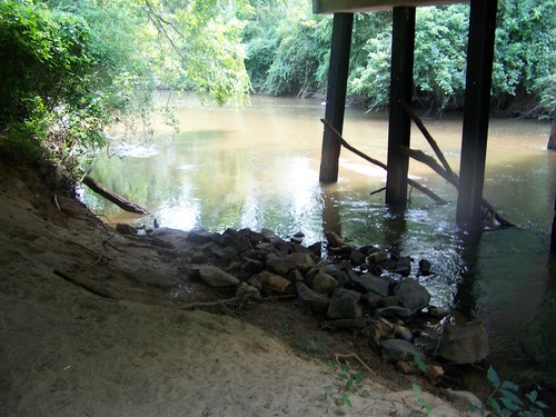
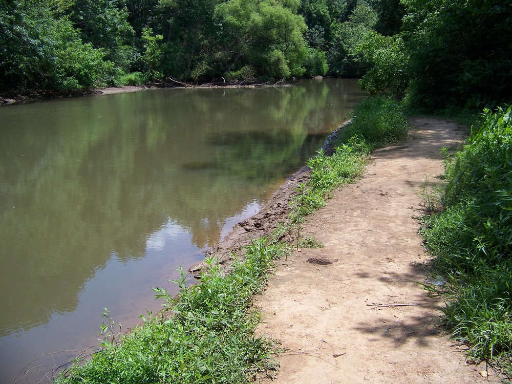
At the intersection with Marler Road, a very short dirt path leads from the upstream side of Dunklin Bridge Road, underneath the bridge, to river left. Parking is limited; pull cars completely off the road and no not park on private property. This access is unofficial but widely used. Use at your own risk.

Trip Details

Dunklin Bridge Road is only a 10 minute drive from Cedar Falls Park; shuttling cars should take less than half an hour. Paddlers should park at the southern entrance to Cedar Falls Park (not the entrance to the playground). Put in below the Cedar Falls Dam and shoals. A mile into the trip, paddlers will paddle through Horseshoe Bend, a 3,500 foot horseshoe-shaped bend in the river. McKittrick Bridge Road is the first road crossing, and there are shoals and Class I-II Rapids between this bridge and the next road crossing, Hillside Church Road, 1.3 miles downstream. The last stretch of the river is relatively flatwater with a few ripples. Paddlers will cross under two sets of power lines, the second set 85 feet before the Dunkling Bridge Road bridge (take out). Paddlers should take out upstream of the bridge, river left. Limited roadside parking is available along Dunklin Bridge Road.

Waterway: 

Comments (4)

Please Sign In or Create Account to add your photo to this trip
Jessi Spring
May 10, 2022 8:15 pm EDT
I did this trip today with the flow listed at 4.88. Ever so slightly above the minimum. I scraped bottom several times and many times it was too shallow to paddle. Twice the river was blocked with debris. But definitely still runnable even at 4.88. It was a great day for it. Saw tons of wildlife including deer running by.
Fred Mendyka
Apr 13, 2021 9:58 pm EDT
Did Cedar Falls Park to Charlie Lollis Memorial Park today. 14.2 miles. Water level of 5.25 was perfect. Able to paddle the river bank to bank. Good current pushed us along. Dropped in at 10:08 AM, pulled out at 3:20 PM. A few snack/stretch stops along the way. A spectacular day. The Reedy was a great river to be on today. Only one portage due to a massive snag across the river a bit beyond the Dunklin Bridge. Went under/over another 6 trees. Did not take our Old Town Discovery 11'9" canoes over the rapids just before pull out. Just could not see a good line for the canoes. A kayak would have done fine.
Alex Long
Jan 30, 2021 1:55 am EST
I live in this area and my property backs up to the Reedy right before Hillside Church Road. I put in at cedar falls on the right hand side of the park and slide in off a big rock. I take out at my property right before Hillside Church so I can't comment about the section between Hillside Church and dunklin Bridge. The float is pretty easy. I've done this trip quite a few times and it is always changing after every big rain. I've done the trip right at the minimum or a little lower around 4.5 ft. Usually I will have to get out once to go around something between Mckittrick Road and Hillside Church. There is a hard bend in the river in this area and it catches a lot of debris. In the video in the above comment, I believe this area is where the deer crossed. Every once and a while I'll take a small chainsaw on my trip and try to clear a spot to travel if anything is blocking but it constantly changes. The highest I've floated this trip is probably around the 8ft mark. The river has good flow and constant speed the entire trip. Anything over this, the river is pretty high and over the banks. This website says 12 ft but I would not float this above 8. I say this because there are so many trees and the strainers are hidden. In my opinion the higher the river the more chance you have of getting caught up. If the river is around the 5 ft mark, majority you can get out and it is between shin and waist high but there are some holes especially around the blockages. There are not any rapids in the area I float. I use a cheap kayak from a sports store. I would not recommend a tube because I think it would get popped easily.
Ken Boone
Jun 08, 2019 9:11 am EDT
We took this trip on May 25, 2019 with a River Flow of 5.2 FT, just above the minimum for safe paddling. The river was low but we made it through without getting grounded. I think this river changes with every storm, as the description above states that the last stretch of the river is relatively flat water with a few ripples. We found the contrary to be true. The last part of the river, beyond Hillside Church Rd was the most challenging. This was due to lots of timber down in the river in this stretch. This area also had the fastest flow. I posted a video that highlighted our trip. You can view it here: https://youtu.be/cj4XaFCOhgI Boone Down South
Please Sign In or Create Account to add your photo to this trip
shoals at Cedar Falls Park (Credit: Upstate Forever)
Cedar Falls Dam (Credit: Upstate Forever)
portage trail around Cedar Falls Dam (Credit: Upstate Forever)
shoals at Cedar Falls Park (Credit: Upstate Forever)
trail leading beneath Dunklin Bridge Road (Credit: Upstate Forever)
Reedy River below Dunklin Bridge Road (Credit: Upstate Forever)
Trip Resources
Download map files for your own use. Learn more
River Flow (FT)
Discharge flow information
CURRENT FT
Flows for safe padding (ft)
MINIMUM
4.8
MAXIMUM
12
X Close
Skill Level
Easy
Moderate
Difficult
Advanced
Learn more
X Close
Flow Level
Runnable
Above Runnable
Below Runnable
No Information
Learn more
X Close
Skill & Flow Level
Easy
Moderate
Difficult
Advanced
Runnable
Above Runnable
Below Runnable
No Information
X Close
Access Amenities
Parking - Dedicated Lot
Parking - Roadside
Restroom / Toilets
Fee Required
Handicap Accessible
Camping
Paddle SC is presented by
Upstate Forever
South Carolina Department of Natural Resources
South Carolina National Heritage Corridor
Rainey Foundation