Paddle SC
Camping Fee Required Handicap Accesible Parking- Dedicated Lot Roadside Parking Restrooms / Toilets

Pacolet River: Lower Pacolet Shoals to Skull Shoals

Scroll down for more details
Legend
Hide All

Pacolet River: Lower Pacolet Shoals to Skull Shoals

Skill Level: Moderate
Loading 
Rapids: Class I , II
Length: 16.80 miles
Duration: 8.5 - 9 hours
Portaging: No
What to Expect

This lengthy but lazy trip is characterized by slow moving waters, rural scenery, and culturally significant points of interest, including Grindall and Skull Shoals. This trip is suitable for novice paddlers who want an extended day trip.

Access
Put in:
Lower Pacolet Shoals Put In
 167 Montgomery Avenue, Pacolet, SC 29372
Access Details

To get to the put in off of Montgomery Road, turn onto the gravel road across from the Pacolet Town Hall Building; follow the gravel/dirt road for 0.35 miles to the end. There will be signs on Montgomery Road indicating where to turn onto the gravel road.  The river access is along the channel downstream from the Lower Pacolet Mills Dam. Restrooms are available adjacent to the water tower by the bridge on Sunny Acres Drive. Paddling in between the two dams is not permitted.

Take out:
Skull Shoals Road River Access and Parking Area
 539 Skull Shoals Road, Gaffney, SC 29342
Access Details

The access and gravel parking area are located downstream of the bridge, river left (east of the bridge). From the road, drive 450 feet down a gravel path to the parking area and boat ramp. This is the last road crossing before the confluence of the Pacolet River with the Broad River; the next take out is the Town of Lockhart, 12 miles downstream (4-5 hours). 

Trip Details

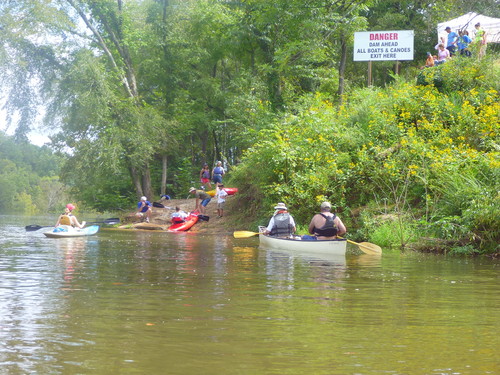
Skull Shoals River Access is 20-25 minutes away from the Lower Pacolet Shoals put in, so shuttling cars could take close to an hour. This section is characterized by its slower moving water/flatwater. Although this stretch of the Pacolet River is primarily rural in nature and includes slower moving waters, this is not an ideal beginner-friendly paddle trip due to the length of the trip. The Skull Shoals River Access is located at the second road crossing along this stretch. Take out downstream of the bridge (Skull Shoals Road) river left. This is the last take out before the confluence of the Pacolet and Broad Rivers. For additional information, view Upstate Forever's Pacolet River and Lawson's Fork Creek Blueway Map.

Waterway: 

Comments (3)

Please Sign In or Create Account to add your photo to this trip
Sean Holbrook
Apr 27, 2021 4:18 pm EDT
Does anyone know if there is any camping spots along this section?
marvin phifer
Mar 01, 2021 8:25 am EST
Jim, We plan on starting Pacolet accessing gate controlled by Power Company, taking out at Skulls Shoals. This large tree, can it be portaged around, or climbed over?
Jim Hannah
May 03, 2020 8:18 pm EDT
Nice trip. Easy put it and take out. Lots of trees down due to recent heavy storms this year including a large tree across the entire river about half way through the trip. Was able to just get under it near the right bank but it was tight. Otherwise a great paddle.
Please Sign In or Create Account to add your photo to this trip
take out at Upper Pacolet Shoals (Credit: Upstate Forever)
Trip Resources
River Flow (CFS)
Discharge flow information
CURRENT CFS
Flows for safe padding (cfs)
MINIMUM
325
MAXIMUM
750
X Close
Skill Level
Easy
Moderate
Difficult
Advanced
Learn more
X Close
Flow Level
Runnable
Above Runnable
Below Runnable
No Information
Learn more
X Close
Skill & Flow Level
Easy
Moderate
Difficult
Advanced
Runnable
Above Runnable
Below Runnable
No Information
X Close
Access Amenities
Parking - Dedicated Lot
Parking - Roadside
Restroom / Toilets
Fee Required
Handicap Accessible
Camping
Paddle SC is presented by
Upstate Forever
South Carolina Department of Natural Resources
South Carolina National Heritage Corridor
Rainey Foundation