Paddle SC
Camping Fee Required Handicap Accesible Parking- Dedicated Lot Roadside Parking Restrooms / Toilets

Lawson's Fork Creek: Edwin M. Griffin Nature Preserve to Glendale Dam

Scroll down for more details
Legend
Hide All

Lawson's Fork Creek: Edwin M. Griffin Nature Preserve to Glendale Dam

Skill Level: Difficult
Loading 
Rapids: Class II , III
Length: 4.80 miles
Duration: 2.5 - 3 hours
Portaging: No
What to Expect

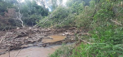
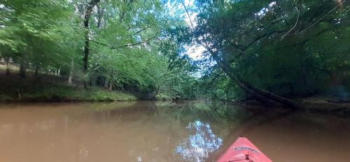
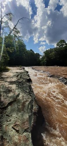
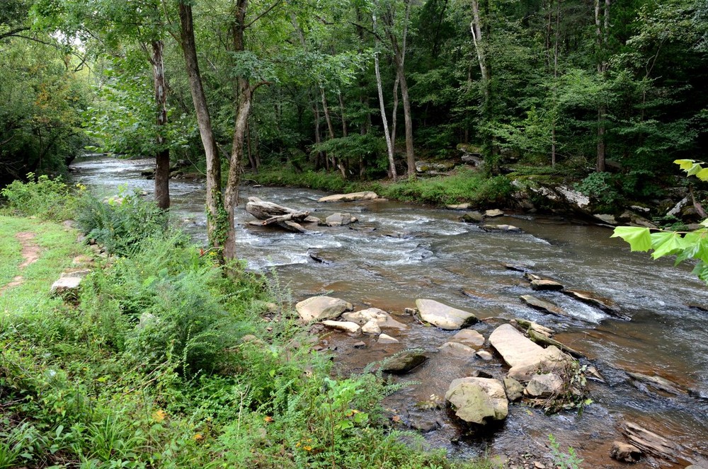
This exciting intermediate stretch of Lawson's Fork Creek includes Class II and III rapids. Because this creek is narrow, paddlers should use caution and expect to encounter strainers or woody debris along the way. Skilled paddlers will enjoy this short stretch of the creek and should expect to encounter a variety of exciting rapids, especially at higher water flows.

Access
Put in:
Edwin M. Griffin Nature Preserve
 220 Sydnor Road, Spartanburg, SC 29302
Access Details

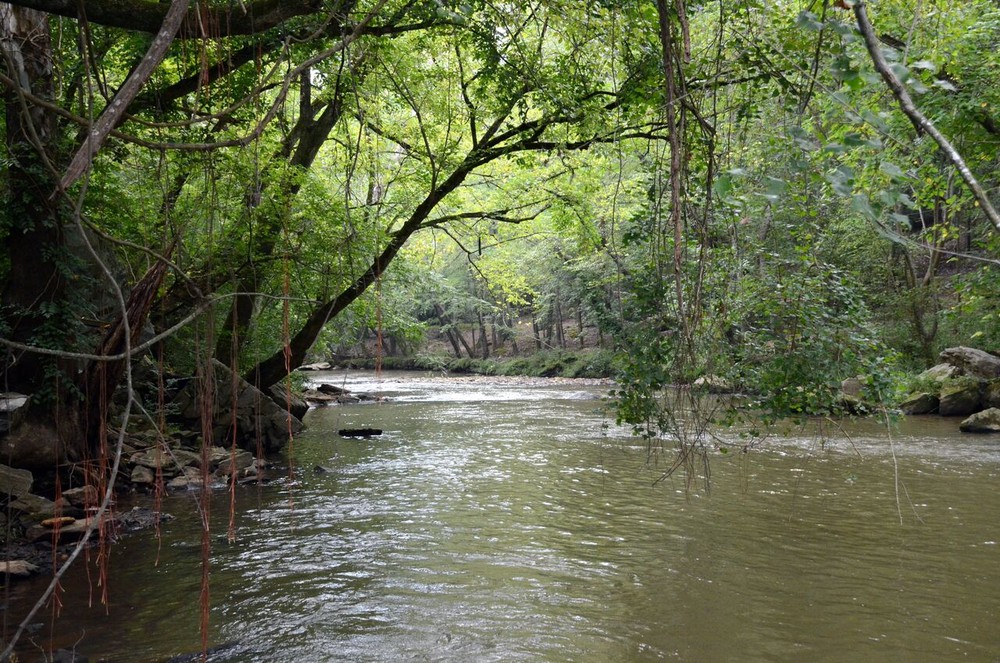
Protecting a 1.5-mile stretch of Lawson's Fork Creek, the Edwin M. Griffin Nature Preserve, is a 115 acre urban preserve and trail system owned by SPACE. Located just minutes from downtown Spartanburg, the preserve offers over 5 miles of trails, numerous plant and wildlife species, green space and wetlands. Parking areas are available on Beechwood and Sydnor Drive.

Take out:
Take Out above Glendale Dam
 103 Emma Cudd Road, Spartanburg, SC 29307
Access Details

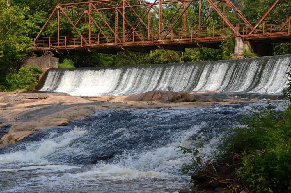
Avoid the dam entirely. Portage is available river right, with river accesses above and below the dam.

Trip Details

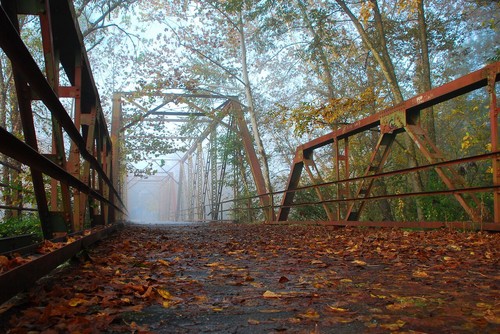
The Glendale Shoals Preserve is only a 10 minute drive from the Edwin M. Griffin Nature Preserve. Paddlers can park at the Cottonwood Trail trailhead and parking area on Sydnor Road and portage boats down the Cottonwood Trail 200 feet to Lawson's Fork Creek. Once on the creek, paddlers will cross under two bridges; the Cottonwood Trail follows the creek on the left bank for the first 1.4 miles. Upon nearing the third bridge, paddlers should prepare to exit the river before reaching the Glendale Dam. Avoid the Glendale Dam entirely. Although the dam is not large, it poses a significant hazard to paddlers. After crossing under the third bridge (Clifton Glendale Road), exit immediately to the right at the take-out and parking area before the Glendale Bridge (foot bridge). For additional information, view Upstate Forever's Pacolet River and Lawson's Fork Creek Blueway Map.

Waterway: 

Comments (2)

Please Sign In or Create Account to add your photo to this trip
Peter Crumb
Jun 13, 2023 11:16 am EDT
Ran this run yesterday two spots I had to hand pull through river blockages three unrecorded Portages first not so bad as trail right next to river the second a bush whack. All these stoppages are correctable with some trail Maint. last blockage i have never seen that much garbage build up on a river. I looked before heading out you said run able. Gopaddlesc get your river reports right. If you are having trouble maintaining reach out and ask for help.clearing crews can help. SC has some potentially beautiful waterways . N, S, middle tigers Lawsons creek and many others. What can I do to help make these water ways the destinations they need to be
Hannah Barney
Apr 07, 2021 8:06 am EDT
Tried this on April 4th. There was so many fallen trees and complete blockages of the river. We had to drag our Kayaks over trees or get out and go around the larger blockages. As soon as we got back in our kayaks, we would have to get out again because of another blockage.
Please Sign In or Create Account to add your photo to this trip
Lawson's Fork Creek at Glendale Shoals Preserve (Credit: Dick Carr)
Glendale Dam (Credit: Dick Carr)
Pedestrian Bridge at Glendale Shoals Preserve (Credit: Dick Carr)
shoals at Glendale Shoals Preserve (Credit: Dick Carr)
This is a disgrace (Credit: Light fighter / Off trail ops)
This is what it should be top to bottom Lawson forks run (Credit: Light Fighter / Off trail ops)
Careful probably best to port/ go left to low to run (Credit: Light fighter/ off trail ops)
Trip Resources
River Flow (CFS)
Discharge flow information
CURRENT CFS
Flows for safe padding (cfs)
MINIMUM
150
MAXIMUM
1000
X Close
Skill Level
Easy
Moderate
Difficult
Advanced
Learn more
X Close
Flow Level
Runnable
Above Runnable
Below Runnable
No Information
Learn more
X Close
Skill & Flow Level
Easy
Moderate
Difficult
Advanced
Runnable
Above Runnable
Below Runnable
No Information
X Close
Access Amenities
Parking - Dedicated Lot
Parking - Roadside
Restroom / Toilets
Fee Required
Handicap Accessible
Camping
Paddle SC is presented by
Upstate Forever
South Carolina Department of Natural Resources
South Carolina National Heritage Corridor
Rainey Foundation