Paddle SC
Camping Fee Required Handicap Accesible Parking- Dedicated Lot Roadside Parking Restrooms / Toilets

Enoree River: Fountain Inn Road (Unofficial) to Kilgore Bridge Road (Unofficial)

Scroll down for more details
Legend
Hide All

Enoree River: Fountain Inn Road (Unofficial) to Kilgore Bridge Road (Unofficial)

Skill Level: Moderate
Loading 
Rapids: Class I , II
Length: 11.50 miles
Duration: 6 - 6.5 hours
Portaging: No
What to Expect

This section is long - the next take out after Fountain Inn Road is 11.5 miles downstream. There are shoals at the front end of the trip, flatwater in the center with intermittent shoals/ripples and a high potential for woody debris / fallen trees.

Access
Put in:
Fountain Inn Road River Access (Unofficial)
 2199 Fountain Inn Road, Woodruff, SC 29388
Access Details

This access is a put-in or take-out only. No roadside parking is available. Please unload boats and put-in downstream of the bridge, river-right. Please do not leave cars along the road's shoulder.

Take out:
Kilgore Bridge Road (Unofficial)
 2790 Kilgore Bridge Road, Woodruff, SC 29388
Access Details

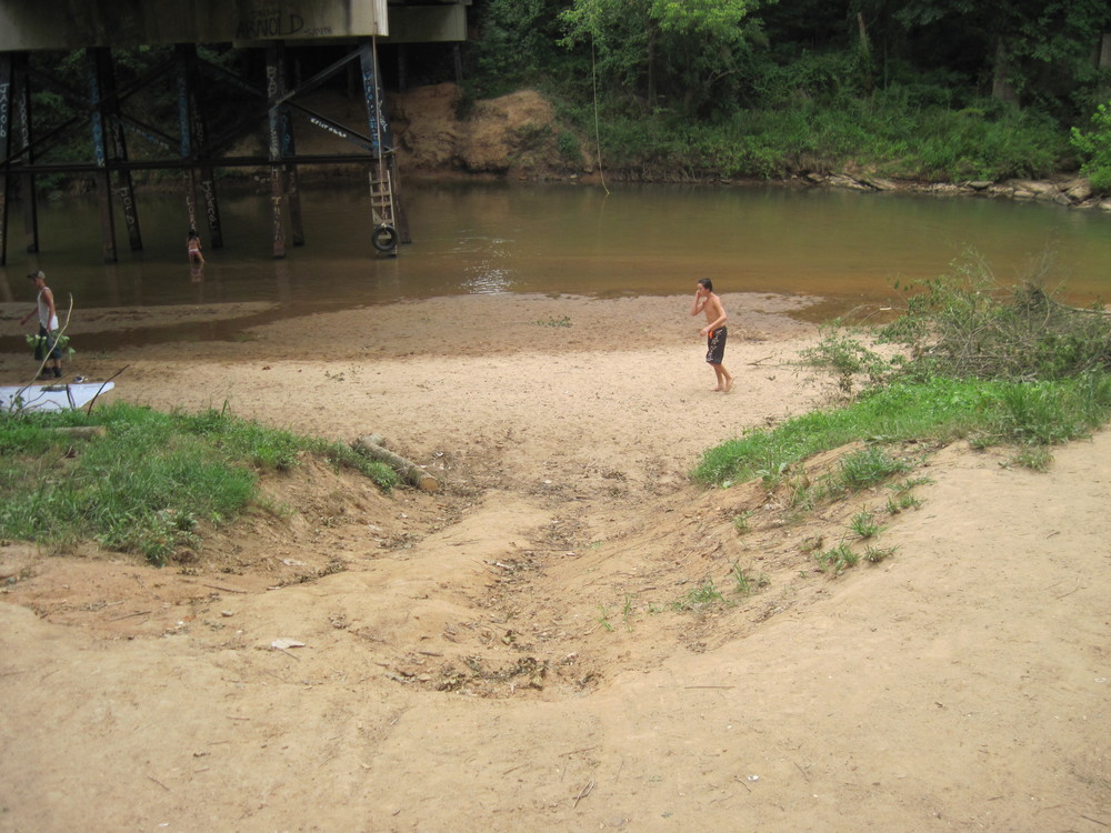
Roadside parking is available on both sides of the road north of the river (river-left). Follow the dirt trail below the bridge to the sandy beach. This access is unofficial but widely used. Use at your own risk.

Trip Details

Kilgore Bridge Road is a 20-minute drive from Fountain Inn Road, so shuttling cars could take around 45 minutes. Immediately after putting in, there are large shoals that can be Class III in high water. There is another set of large shoals beginning 2,000 feet downstream of Fountain Inn Road. Kilgore Bridge Road is the 4th bridge after putting in the river. Take out downstream of the bridge, river-right. Limited roadside parking is available on the downstream right side of Kilgore Bridge Road.

Waterway: 

Comments (0)

Please Sign In or Create Account to add your photo to this trip
small beach below Kilgore Bridge Road (Credit: Upstate Forever)
Trip Resources
Download map files for your own use. Learn more
River Flow (CFS)
Discharge flow information
CURRENT CFS
Flows for safe padding (cfs)
MINIMUM
250
MAXIMUM
1500
X Close
Skill Level
Easy
Moderate
Difficult
Advanced
Learn more
X Close
Flow Level
Runnable
Above Runnable
Below Runnable
No Information
Learn more
X Close
Skill & Flow Level
Easy
Moderate
Difficult
Advanced
Runnable
Above Runnable
Below Runnable
No Information
X Close
Access Amenities
Parking - Dedicated Lot
Parking - Roadside
Restroom / Toilets
Fee Required
Handicap Accessible
Camping
Paddle SC is presented by
Upstate Forever
South Carolina Department of Natural Resources
South Carolina National Heritage Corridor
Rainey Foundation