Paddle SC
Camping Fee Required Handicap Accesible Parking- Dedicated Lot Roadside Parking Restrooms / Toilets

Broad River: Peak to Harbison State Forest

Scroll down for more details
Legend
Hide All

Broad River: Peak to Harbison State Forest

Skill Level: Moderate
Loading 
Rapids: Class I
Length: 16.60 miles
Duration: 6 - 8 hours
Portaging: No
What to Expect

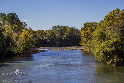
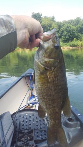
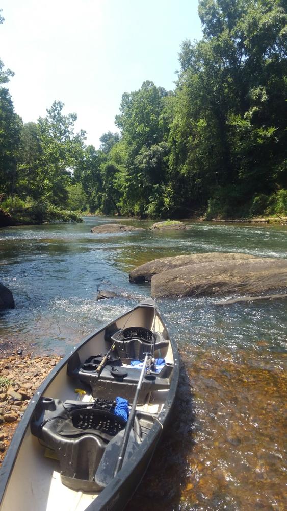
The Broad River tumbles over many small shoals and threads its way around forested islands along this scenic and secluded stretch. You are almost guaranteed to spot a Bald Eagle along this stretch of river. 

Access
Put in:
Peak-Alston Canoe Access
 Palmetto Trail, Peak Access
State Rd S-20-35, Little Mountain, SC 29075
Access Details

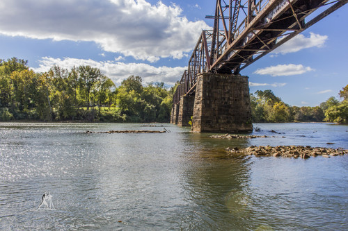
Hand-carry access is available from the Palmetto Trail parking area. Follow the path down under the old railroad trestle that is now a part of the Palmetto Trail. 

There is an alternative put-in access approximately 1 miles upstream, on the west bank of the river, at the SC Hwy 213 bridge. 

Take out:
Harbison State Forest
 Harbison State Forest
5600 Broad River Rd, Columbia, SC 29212
Access Details

Harbison State Forest provides a hand-carry access to the Broad River. Be sure to fill out a float plan and contact the Harbison State Forest office during business hours to get access to the canoe launch. 

Trip Details

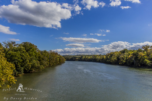
This is a good full-day of scenic and secluded paddling. This stretch of the Broad has very little development. There are no motor-boat launches and there are plenty of shallow shoals, so only paddle craft can take advantage of this remote stretch. You'll probably see more wildlife than other people on the water.  

This trip begins at the trailhead for the Peak to Prosperity Passage of the Palmetto Trail. Camping is allowed at the trailhead (3-nights max). Be sure to take some time to explore this section of the Palmetto Trail before or after your paddle. 

The trip ends at Harbison State Forest, with more than 2,000 acres and 30 miles of trails to explore on foot or on a mountain bike. Be sure to contact the forest office to file a float plan and gain access to the canoe launch. 

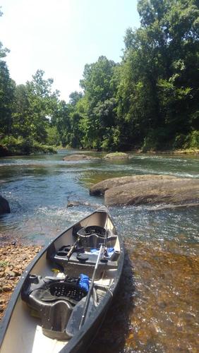
The water is easily navigable. This trip was rated moderate because of the long distance and relative remoteness. It is recommended that at least one person in the group have paddling experience. 

Waterway: 

Comments (3)

Please Sign In or Create Account to add your photo to this trip
Ken Boone
Jun 16, 2021 1:22 pm EDT
Did this trip on June 11th with the CFS between 3000-4000. We tried to fish this trip, but this trip is just too long to take time to fish. You can check out my overview of this trip with more details on YouTube: https://youtu.be/rrTfOLYSswg The Alston trailhead landing was great but the take out spot at Harbison was not so great. It was not marked at all! I used the mapping software on my phone to track where I was in relation to my parked truck to find the creek that took you to the landing spot. The canoe launch area there was not great. They have some railroad tie steps going down to the water, except they don't make it to the water.. about 2 feet high. Nothing but steep slick mud bank. I slipped in the mud and the only thing I could grab was more mud and into the creek I slid. I guess what I am saying is this take out spot could use a little work and it really should be marked where the creek comes out on the river. The river run itself is nice with a lot of scenery and wildlife. We saw plenty of eagles, some ospreys, hawks, herons, otters, etc.. on this trip. We got to watch one eagle take a straight down dive to the river to catch a fish. That was pretty cool! The folks at Harbison State Forest were good to work with on getting details of how things work there with filing a float trip and getting access to the canoe launch area. Check out the video I mentioned to get an idea of what this trip is like.
Will Dennis
Nov 12, 2020 1:41 pm EST
Did you see any spots that would be suitable for overnight camping. Also considering the nightly rising water? Thanks.
Kevin Johnson
Jun 15, 2020 10:43 am EDT
Completed this trip on June 14th with two other paddlers. The CFS was between 2000-3000 while we were on the water. We were paddling into the wind and it took us 8.5 hrs of water time and an additional 30 minutes for stops. We chose the boat access at hwy 213 which added 1.5 miles to the trip. In hindsight, the Palmetto Trail landing listed in the description might have been a better option. We had hoped for more "beachy" areas around the islands. There are plenty of opportunities to take a break on rocks in the river (lots), but we didn't really see many opportunities on the banks or otherwise that weren't private property. Overall it was a great trip. We saw bald eagles, otters, heron, etc. The several small areas of rapids were just enough to be fun. The access at 213 is under the bridge but getting your boat into the water is a rather steep shot down a sandy embankment. When we took out at Harbison we had to walk in mud up to our calves to reach the steps and then it was ok. That sinking feeling is never comfortable! :-) If you're looking for an all day adventure this is a good one but I think it would be better enjoyed as an overnight. To access Harbison, you have to contact the State Forest their and submit a float trip plan prior to your trip for approval. They'll give you a code for the gates so you can have flexibility in your times. Overall it was a great trip. If I did it again, I'd want to find a place to camp along the way and spend the night.
Please Sign In or Create Account to add your photo to this trip
Broad River from Palmetto Trail crossing. (Credit: Davey Borden, via Flickr: CC BY-ND 2.0)
Palmetto Trail crossing over the Broad River (Credit: Davey Borden, via Flickr (CC BY-ND 2.0))
Broad River (Credit: Davey Borden, via Flickr: (CC BY-ND 2.0))
Taking a break
Small mouth Bass
Trip Resources
Download map files for your own use. Learn more
River Flow (CFS)
Discharge flow information
CURRENT CFS
Flows for safe padding (cfs)
MINIMUM
500
MAXIMUM
10000
X Close
Skill Level
Easy
Moderate
Difficult
Advanced
Learn more
X Close
Flow Level
Runnable
Above Runnable
Below Runnable
No Information
Learn more
X Close
Skill & Flow Level
Easy
Moderate
Difficult
Advanced
Runnable
Above Runnable
Below Runnable
No Information
X Close
Access Amenities
Parking - Dedicated Lot
Parking - Roadside
Restroom / Toilets
Fee Required
Handicap Accessible
Camping
Paddle SC is presented by
Upstate Forever
South Carolina Department of Natural Resources
South Carolina National Heritage Corridor
Rainey Foundation