Paddle SC
Camping Fee Required Handicap Accesible Parking- Dedicated Lot Roadside Parking Restrooms / Toilets

Cedar Creek (Congaree NP): Bannister Bridge to Cedar Creek Landing

Scroll down for more details
Legend
Hide All

Cedar Creek (Congaree NP): Bannister Bridge to Cedar Creek Landing

Skill Level: Moderate
Loading 
Rapids: None
Length: 6.00 miles
Duration: 4 - 6 hours
Portaging: Yes
What to Expect

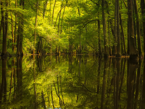
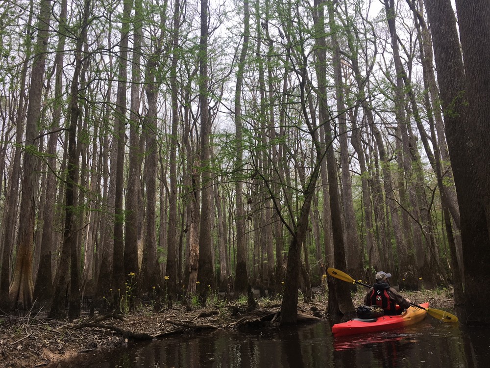
Good day paddle through Congaree National Park on a blackwater creek provides solitude and adventure. Paddlers travel past oaks and immense loblolly pines of near record proportions growing on either side of the creek.

Access
Put in:
Bannister Bridge Landing
Access Details

Gravel parking area with a hand-carry boat launch.

Take out:
Cedar Creek Landing
Access Details

Gravel parking area with a hand-carry boat launch.

Trip Details

Cedar Creek starts out narrow and gradually widens as you travel downstream. At the halfway point, the creek passes near Wise Lake, a former channel of the Congaree River, which is accessible when water levels are higher. The trail ends at Cedar Creek Landing, which is marked by an iron bridge over the creek. The upper portion of this paddle is likely to have fallen trees that can create obstacles across the stream, which gives this paddle an intermediate rating. Use caution when navigating or portaging around fallen trees. Paddle times vary depending on flow and the number of obstacles along the stream. The Congaree National Park website has more information on the park and the paddling trail. You can call (803) 776-4396 for current conditions in the park. The Cedar Creek USGS streamflow gage gives current flow conditions, which can be compared to this chart for expected conditions.

Comments (5)

Please Sign In or Create Account to add your photo to this trip
Bennett Dixon
Mar 04, 2023 10:42 pm EST
This place is stunning. Paddled this section today from 11:00 to about 3:30 pm in a Mad River Canoe. Water level was around 3.4, which had it pros and cons, such as never having any confusion about which way to go and easily navigating most obstacles in the first three miles (i.e. water was low enough to go under several trees that would have required portaging at 1 or 2 feet higher). Cons included water level being too level for several (maybe 7) portages farther down in the last three miles that weren't impossible but certainly weren't easy. We got pretty muddy. Took a 30 minute lunch break near Wise Lake and generally had an amazing time though! Definitely my preferred way to see what Congaree has to offer.
Chris Miller
Dec 30, 2022 7:57 pm EST
Paddled this route on 12/29/2022. Water level at 5 Ft. Paddled in a 9.5 ft Pelican which is ideal for this river (low draw, very maneuverable). Encountered lots of obstacles (this is full contact paddling but very fun). Two places I needed to step over a tree across the stream while the boat went under. Three where the boat and I barely made it under a tree. Two places I had to shimmy through debris and over a log, and two portages (very muddy). Sighted 3 deer, a river otter and many ducks.
Russ Bowen
Nov 10, 2022 8:02 am EST
Paddled on Nov 8, 2022 with guage reading 2.90 ft. with a canoe loaded with 2 people and camping gear. We needed to portage around a dozen times. We enjoyed the float. There were few mosquitos, snakes, and people at this time of year on a weekday.
Julie Lindley
Aug 04, 2019 9:43 am EDT
If you don’t enjoy getting out of your kayak and climbing over trees in a swamp this is not the paddle for you! If you don’t mind portaging your kayak multiple times in a short period go for this trip! I really wish someone would come in with a chainsaw and make this route more passable because it truly is a beautiful creek. Just watch out for snakes and spiders and mosquitos. Bring repellent!
Michael Caldwell
Mar 30, 2019 7:54 am EDT
Good paddle, bring a map and pay attention. Lots of snakes and many portages.
Please Sign In or Create Account to add your photo to this trip
Spring Shed Ahead (Credit: The Outdoorsy Lens LLC, JoAnn Johnson)
Peace Between Portages (Credit: JoAnn Johnson, TheOutdoorsyLens.com)
Trip Resources
Download map files for your own use. Learn more
River Flow (FT)
Discharge flow information
CURRENT FT
Flows for safe padding (ft)
MINIMUM
2
MAXIMUM
8
X Close
Skill Level
Easy
Moderate
Difficult
Advanced
Learn more
X Close
Flow Level
Runnable
Above Runnable
Below Runnable
No Information
Learn more
X Close
Skill & Flow Level
Easy
Moderate
Difficult
Advanced
Runnable
Above Runnable
Below Runnable
No Information
X Close
Access Amenities
Parking - Dedicated Lot
Parking - Roadside
Restroom / Toilets
Fee Required
Handicap Accessible
Camping
Paddle SC is presented by
Upstate Forever
South Carolina Department of Natural Resources
South Carolina National Heritage Corridor
Rainey Foundation