Paddle SC
Camping Fee Required Handicap Accesible Parking- Dedicated Lot Roadside Parking Restrooms / Toilets

Turkey-Stevens Canoe Trail: SC Hwy 283 to Key Bridge

Scroll down for more details
Legend
Hide All

Turkey-Stevens Canoe Trail: SC Hwy 283 to Key Bridge

Skill Level: Moderate
Loading 
Rapids: Class I
Length: 4.20 miles
Duration: 2.5 - 4 hours
Portaging: No
What to Expect

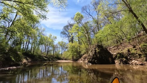
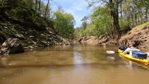
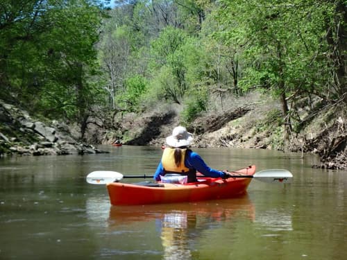
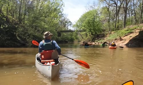
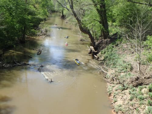
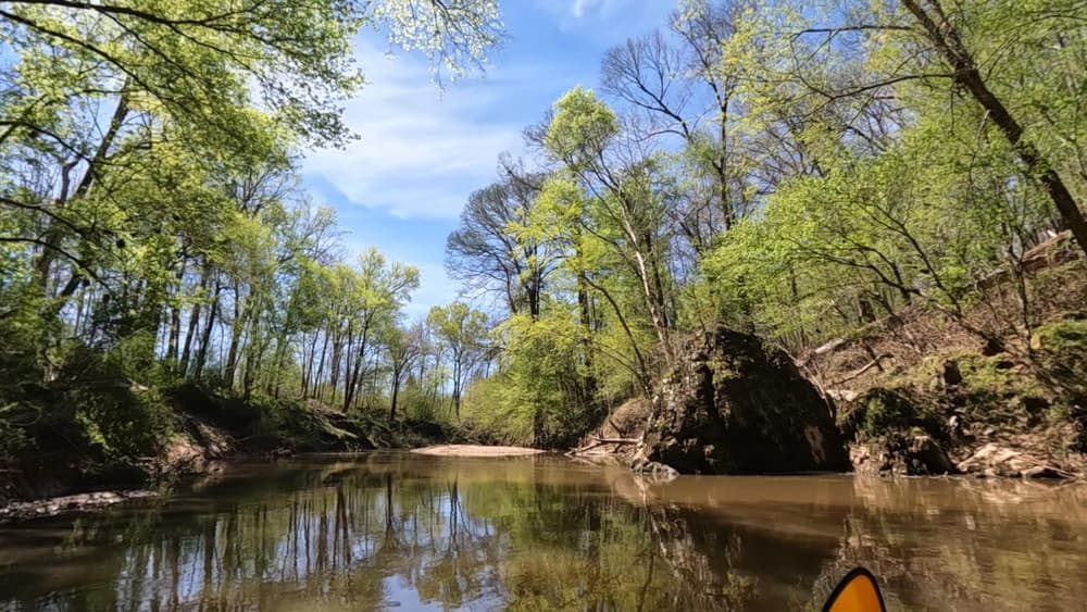
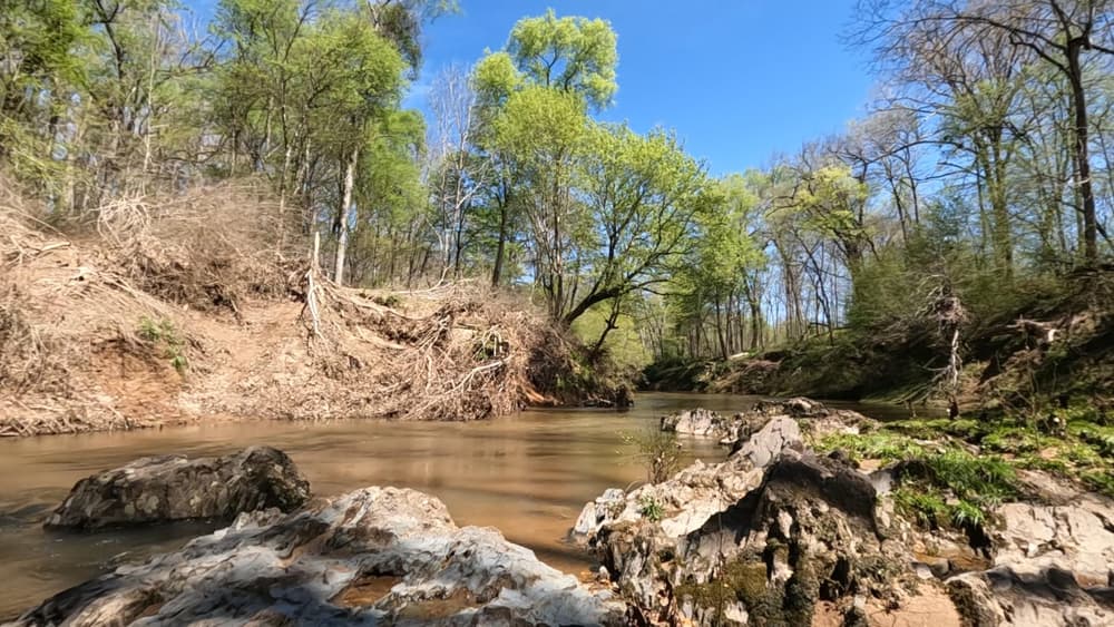
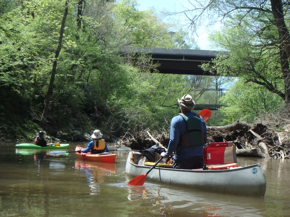
This US National Forest paddling trail along Turkey and Stevens Creeks shows off a mix of rocky shoals and steep bluffs typically found along Piedmont streams with cypress trees and floodplain forests more common in the coastal plain. Small rapids and some downed trees keep you on your paddling toes. 

Access
Put in:
SC Hwy 283 (Plum Branch Rd)
Access Details

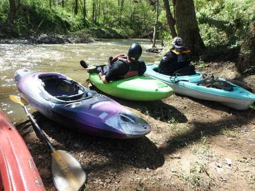
Limited parking area is on the east side of the creek, south of the road. 

Take out:
Key Bridge (Price's Bottom)
Access Details

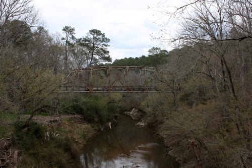
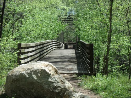
The Prices Bottom area provides access to multiple activities including hiking, biking, and Turkey Creek. The dirt road turnoff to this access is 0.1 miles south of the bridge. 

Trip Details

This section is entirely on Turkey Creek. Steep hardwood bluffs, flood pain forests and small marshy areas are a few of the varied habitats that visitors will encounter on this trail located on the southeastern part of the Long Cane Ranger District. 

Interesting plants such as bloodroot, anemone and the crane-fly orchid, and wildlife including hawks,
raccoons and turkeys, are a few of the things that can be seen by boaters.

Free permit required for overnight camping. This canoe trail is extremely dangerous at flood stage. Water levels rise quickly after heavy rains. Check local weather conditions. Learn the terrain and know access points. Portaging may be required over fallen trees. 

Comments (4)

Please Sign In or Create Account to add your photo to this trip
Paula Cumalander
Apr 10, 2024 3:34 pm EDT
Paddled on April 6, 2024. Level was 3.91ft. After scouting the put in (wooded steps were rotted and a steep bank to the water), we decided to go across the bridge and put in across from the one listed. It was still a little steep, but not as bad. This was a great water level, river was flowing with a few ripples and class I rapids. The river was wide enough to avoid any strainers. This is a beautiful river with some big rocks and high banks. We took out between the 2 bridges. Due to recent flood levels, this was a very, very slippery bank. We had to use ropes to get ourselves and the kayaks up it.
Rebecca Brown
Mar 11, 2024 1:29 pm EDT
Paddled this section yesterday with 2 kayaks and a canoe. Water was at 14'. Good flow - there was one tree across the creek that we barely squeaked under on the far right. Otherwise, river was clear. Most difficult aspect was putting in - wooden stairs down to he water were unusable due to mud. We used a rope to slide down the bank. Trip took about 2 hrs.
Mary Caddell
Apr 15, 2021 9:13 pm EDT
Key Bridge Road is closed at present as bridge is being replaced. 4/14/21. No access from Modoc side
Rebecca Brown
May 01, 2020 9:10 pm EDT
Paddled it at 11' today, 5/1/20. There was a log jam that will be challenging as water goes down. It looks possible to portage around. Took 2 hrs taking it easy with a couple short stops.
Please Sign In or Create Account to add your photo to this trip
This 1925 Parker through truss bridge was relocated from US 17 in 1961 to replace the one-lane Key Bridge. (Credit: Flickr user cmh2315fl (CC BY-NC 2.0))
Put -in across the river from the designated one (Credit: pcumalander-frick)
A big rock on the river (Credit: pcumalander-frick)
(Credit: pcumalander-frick)
Some high banks (Credit: pcumalander-frick)
(Credit: pcumalander-frick)
Looking for a take-out between the Key Bridges (Credit: pcumalander-frick)
That slippery, steep bank is the take out (Credit: pcumalander-frick)
Old Key Bridge (Credit: pcumalander-frick)
Group going down. Taken from Old Key Bridge (Credit: pcumalander-frick)
Trip Resources
River Flow (FT)
Discharge flow information
CURRENT FT
Flows for safe padding (ft)
MINIMUM
2.5
MAXIMUM
18
X Close
Skill Level
Easy
Moderate
Difficult
Advanced
Learn more
X Close
Flow Level
Runnable
Above Runnable
Below Runnable
No Information
Learn more
X Close
Skill & Flow Level
Easy
Moderate
Difficult
Advanced
Runnable
Above Runnable
Below Runnable
No Information
X Close
Access Amenities
Parking - Dedicated Lot
Parking - Roadside
Restroom / Toilets
Fee Required
Handicap Accessible
Camping
Paddle SC is presented by
Upstate Forever
South Carolina Department of Natural Resources
South Carolina National Heritage Corridor
Rainey Foundation