Paddle SC
Camping Fee Required Handicap Accesible Parking- Dedicated Lot Roadside Parking Restrooms / Toilets

South Tyger River: S. Spencer Street (Unofficial) to Berry Shoals Pond

Scroll down for more details
Legend
Hide All

South Tyger River: S. Spencer Street (Unofficial) to Berry Shoals Pond

Skill Level: Easy
Loading 
Rapids: Class I
Length: 5.60 miles
Duration: 3 - 3.5 hours
Portaging: No
What to Expect

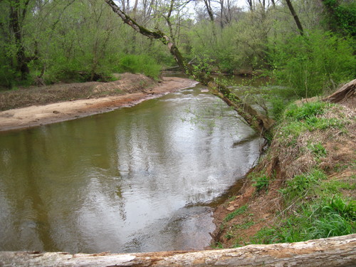
This stretch is primarily flatwater as the South Tyger River enters Berry Shoals Pond. Beginner friendly and short, this trip can be done in a half day or less.

Access
Put in:
South Spencer Street Roadside Parking and River Access (Unofficial)
 521 S. Spencer Street, Duncan, SC 29334
Access Details

The parking area and river access is located northwest of the road, or river-right, before South Spencer Street turns in to Duncan Reidville Road. Pull cars completely off the road and park on the upstream left side of the river (northwest side). Follow the grassy path down to the river. The bank is steep at this river access, so paddlers should use caution when entering the river. Please do not climb on the fence or enter the pasture lands to the right of the parking area, as this is private property with livestock. 

Take out:
Brown's Bait and Tackle Shop
 404 Berry Shoals Road, Duncan, SC 29334
Access Details

Brown's Bait and Tackle shop located on Berry Shoals Road offers parking, boat ramp/launch site, and fishing from the banks. The store is open 7 days a week from 7 AM to 6 PM. There is a $3 boat launch/parking fee applicable to paddlers.

Trip Details

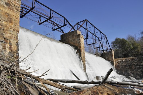
The take out on Berry Shoals Pond is 10 minutes away from South Spencer Street. Portage boats 200 feet to the river, putting in upstream of the South Spencer Street bridge. After crossing under the South Spencer Street bridge, paddlers will cross under three more bridges, including the I-85 bridge, before the river enters Berry Shoals Pond. The take out is located at Brown's Bait and Tackle, on the right side of the pond upstream of the Berry Shoals Road bridge. For more information view the Tyger River Blueway map.

Waterway: 

Comments (0)

Please Sign In or Create Account to add your photo to this trip
S Tyger River at S Spencer Street (Credit: Upstate Forever)
Berry Shoals Dam (Credit: Upstate Forever)
Last mile almost to the lake (Credit: PaulaJ)
Trip Resources
River Flow (CFS)
Discharge flow information
CURRENT CFS
Flows for safe padding (cfs)
MINIMUM
600
MAXIMUM
1000
X Close
Skill Level
Easy
Moderate
Difficult
Advanced
Learn more
X Close
Flow Level
Runnable
Above Runnable
Below Runnable
No Information
Learn more
X Close
Skill & Flow Level
Easy
Moderate
Difficult
Advanced
Runnable
Above Runnable
Below Runnable
No Information
X Close
Access Amenities
Parking - Dedicated Lot
Parking - Roadside
Restroom / Toilets
Fee Required
Handicap Accessible
Camping
Paddle SC is presented by
Upstate Forever
South Carolina Department of Natural Resources
South Carolina National Heritage Corridor
Rainey Foundation